How far is Cary, NC from Forest Oaks, NC?
The driving distance from Cary, NC to Forest Oaks, NC is about 70.8 miles (113.9 km), with a travel time of about 01h 33m by car.
- The straight-line flight distance is about 53.6 miles (86.2 km).
- For a round trip, plan for roughly 03h 06m of driving time before adding stops, traffic, or weather delays.
- A comfortable departure window is usually 8:00 AM to 10:00 AM EDT.
Reverse, save, or send this route
This route works well as a day trip with time at the destination. Copy the route link, send it to another device, or print a clean version before you head out.
This route works well as a day trip with time at the destination.
Flight Distance
Driving Distance
Gas Cost Calculator
Leave and Arrive Planner
Pick a departure time to see your estimated arrival and same-day return window.
Drive time stays fixed at 01h 33m.
A morning start gives you useful time at the destination and keeps the return out of the late evening.
You are leaving earlier than the recommended window, which gives you extra margin for breaks and traffic.
Halfway Point
A useful midpoint for breaks, coffee, or meeting in the middle.
Town in and county seat of Orange County, North Carolina, United States
Route Weather Snapshot
Check the forecast at both ends before you head out.
Partly Sunny
Driving Route Map
The map below follows the saved road route between Cary and Forest Oaks.
Turn-by-Turn Driving Directions
Step-by-step road directions between Cary and Forest Oaks.
-
1
Start on North Academy Street
7 m · 6 sec · North Academy Street
-
2
Turn right onto Chapel Hill Road
625 ft · 19 sec · Chapel Hill Road
-
3
Turn right onto North Harrison Avenue
3.3 mi · 6 min · North Harrison Avenue
-
4
Take the ramp left
1937 ft · 41 sec
-
5
Merge slight left onto Dan K. Moore Frwy.
59.8 mi · 1 hr 9 min · Dan K. Moore Frwy.
-
6
Keep slight left
2.1 mi · 2 min
-
7
Take the exit slight right toward Youngs Mill Road
1161 ft · 28 sec
-
8
Keep slight left to continue on Youngs Mill Road
39 m · 5 sec
-
9
Turn left onto Youngs Mill Road
1.2 km · 2 min · Youngs Mill Road
-
10
Turn right onto Millpoint Road
1.2 km · 2 min · Millpoint Road
-
11
Turn sharp left onto Presbyterian Road
2201 ft · 1 min · Presbyterian Road
-
12
Turn slight left onto Alamance Church Road
47 m · 5 sec · Alamance Church Road
-
13
Turn right onto Southeast School Road
2 mi · 5 min · Southeast School Road
-
14
Turn right onto Belvoir Drive
2565 ft · 2 min · Belvoir Drive
-
15
Turn sharp left
2051 ft · 2 min
-
16
Arrive at your destination
0 m · 1 sec
Car Route Details
A richer read on the saved driving route between Cary and Forest Oaks.
Straightforward drive
The saved road route has a manageable number of maneuvers and should be easy to follow with normal attention to signs.
Dan K. Moore Frwy.
Merge slight left onto Dan K. Moore Frwy.
59.8 mi · 01h 09m
Route Summary
A quick read on whether this route feels easy, ambitious, or worth planning around.
A comfortable day-trip route
This route works well as a day trip. You can leave in the morning, spend meaningful time at the destination, and still return the same day.
Partly Sunny leaving Cary and Partly Sunny near Forest Oaks.
Trip Questions
Direct answers travelers usually want before committing to the drive.
How long does it take to drive from Cary to Forest Oaks?
The road trip is about 70.8 miles (113.9 km) and usually takes 01h 33m in normal driving conditions.
Is this a same-day trip or an overnight route?
This route works well as a day trip. You can leave in the morning, spend meaningful time at the destination, and still return the same day.
What is the halfway point on this route?
Hillsborough is a useful midpoint, sitting about 35.4 miles from Cary and 35.4 miles from Forest Oaks.
How much longer is the road route than the straight-line distance?
The direct path is about 53.6 miles (86.2 km), while the road route adds roughly 17.2 extra miles because roads do not follow the straight air line.
When is the best time to leave for this route?
A good departure window is usually 8:00 AM to 10:00 AM EDT. If you want a more comfortable same-day return, try to leave by 3:24 PM EDT.
How much will gas cost for this route?
Using about 28.3 MPG, regular gas is estimated at $9.90 one way or $19.81 round trip. Estimated CO2 is about 22.2 kg one way.
What should you check before leaving?
Before you leave, expect Partly Sunny around Cary and Partly Sunny near Forest Oaks.
Stop Ideas Near Hillsborough
Useful break, food, and waypoint ideas within about 15 miles of the route midpoint.

Burlington City Switchboard
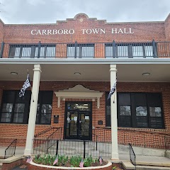
Carrboro Town Hall

The Town Hall Grill
Transit and Meeting Points
Useful pickup, handoff, or rendezvous points close to Hillsborough.
Durham
Burlington
Cary
North Carolina State Fair station
Flight Path Map
This map shows the direct air route between Cary and Forest Oaks. Straight-line distance: 53.53 mi (86.15 km).

#1 Cary
Town in North Carolina, United States
| Population | 173,587 |
| Coordinates | 35.7915400, -78.7811200 |
| Altitude | 152 |
| Country | United States |

#2 Forest Oaks
Township in Guilford County, North Carolina
| Population | 3,890 |
| Coordinates | 35.9881900, -79.7061400 |
| Altitude | 232 |
| Country | United States |
End: Forest Oaks (-79.70614, 35.98819)
Estimated Travel Time
Distance: 114 km by road
| Speed | Time |
|---|---|
| 30 mph (48.3 km/h) | 02h 21m |
| 40 mph (64.37 km/h) | 01h 46m |
| 50 mph (80.47 km/h) | 01h 24m |
| 60 mph (96.56 km/h) | 01h 10m |
| 70 mph (112.65 km/h) | 01h 00m |
| 80 mph (129 km/h) | 00h 52m |
Fuel, Round Trip and CO2
Estimated fuel cost and emissions for this route.
| Fuel | $/gal | One way | Round trip |
|---|---|---|---|
| Regular gas | $3.96 | $9.90 | $19.81 |
| Mid-grade | $4.43 | $11.07 | $22.15 |
| Premium | $4.78 | $11.94 | $23.89 |
| Diesel | $5.62 | $14.06 | $28.12 |
Assumes 8.3 L/100 km (about 28.3 MPG). CO2 is an estimate and varies by vehicle, fuel blend, traffic, and terrain.
Prices in North Carolina · Aug 01, 2026
Distance to Other Cities
Planning a road trip? See the full trip guide on Trip.ovh — stops, fuel costs, weather, and departure timing.