How far is Cape Charles, VA from Portsmouth Heights, VA?
The driving distance from Cape Charles, VA to Portsmouth Heights, VA is about 49.5 miles (79.6 km), with a travel time of about 01h 03m by car.
- The straight-line flight distance is about 36.6 miles (58.9 km).
- For a round trip, plan for roughly 02h 06m of driving time before adding stops, traffic, or weather delays.
- A comfortable departure window is usually 8:00 AM to 10:00 AM EDT.
Reverse, save, or send this route
This route works well as a day trip with time at the destination. Copy the route link, send it to another device, or print a clean version before you head out.
This route works well as a day trip with time at the destination.
Flight Distance
Driving Distance
Gas Cost Calculator
Leave and Arrive Planner
Pick a departure time to see your estimated arrival and same-day return window.
Drive time stays fixed at 01h 03m.
A morning start gives you useful time at the destination and keeps the return out of the late evening.
You are leaving earlier than the recommended window, which gives you extra margin for breaks and traffic.
Halfway Point
A useful midpoint for breaks, coffee, or meeting in the middle.
The most populous city in Virginia, Virginia Beach is a major center for tourism, military, and business.
Route Weather Snapshot
Check the forecast at both ends before you head out.
Mostly Sunny then Slight Chance Showers And Thunderstorms
Patchy Smoke then Mostly Sunny
Driving Route Map
The map below follows the saved road route between Cape Charles and Portsmouth Heights.
Turn-by-Turn Driving Directions
Step-by-step road directions between Cape Charles and Portsmouth Heights.
-
1
Start on Park Row
90 m · 20 sec · Park Row
-
2
Turn left onto Strawberry Street
1252 ft · 1 min · Strawberry Street
-
3
At the end of the road, turn left onto Mason Avenue
2327 ft · 1 min · Mason Avenue
-
4
Turn right onto Randolph Avenue
1561 ft · 31 sec · Randolph Avenue
-
5
Continue on Stone Road
1.7 mi · 3 min · Stone Road
-
6
Turn right onto Lankford Highway
9.7 mi · 13 min · Lankford Highway
-
7
Merge slight left onto Lankford Highway
1.1 mi · 2 min · Lankford Highway
-
8
Continue on Chesapeake Bay Bridge–Tunnel
17.7 mi · 24 min · Chesapeake Bay Bridge–Tunnel
-
9
Continue on Northampton Boulevard
5.1 mi · 8 min · Northampton Boulevard
-
10
Take the exit straight toward I 64 East, I 64 West: Downtown Norfolk, Chesapeake, Suffolk, Hampton, Richmond
600 ft · 15 sec
-
11
Keep slight left to continue on I 64 East: Downtown Norfolk, Chesapeake, Suffolk
2976 ft · 1 min
-
12
Merge slight left onto Hampton Roads Beltway
1.5 mi · 2 min · Hampton Roads Beltway
-
13
Take the exit slight right toward I 264 East, I 264 West: Va Beach, Downtown Norfolk, Portsmouth
914 ft · 14 sec
-
14
Keep slight right to continue on I 264 West: Norfolk
2737 ft · 42 sec
-
15
Keep slight left to continue on I 264 West, US 13 South: Norfolk, Military Highway
1273 ft · 20 sec
-
16
Keep slight left to continue on I 264 West: Norfolk, Portsmouth
2368 ft · 58 sec
-
17
Merge slight left onto Virginia Beach-Norfolk Expressway
7.9 mi · 12 min · Virginia Beach-Norfolk Expressway
-
18
Take the exit slight right toward VA 337 West: Portsmouth Boulevard
3060 ft · 1 min
-
19
Turn left onto Portsmouth Boulevard
1.4 km · 2 min · Portsmouth Boulevard
-
20
Turn right onto Shea Street
1076 ft · 51 sec · Shea Street
-
21
Turn left onto Vick Street
623 ft · 27 sec · Vick Street
-
22
Arrive at your destination
0 m · 1 sec · Vick Street
Car Route Details
A richer read on the saved driving route between Cape Charles and Portsmouth Heights.
Turn-heavy local drive
The route has frequent decision points for its length, so lane choice and turn timing will matter more than cruising speed.
Chesapeake Bay Bridge–Tunnel
Continue on Chesapeake Bay Bridge–Tunnel
17.7 mi · 00h 24m
Route Summary
A quick read on whether this route feels easy, ambitious, or worth planning around.
A comfortable day-trip route
This route works well as a day trip. You can leave in the morning, spend meaningful time at the destination, and still return the same day.
Mostly Sunny then Slight Chance Showers And Thunderstorms leaving Cape Charles and Patchy Smoke then Mostly Sunny near Portsmouth Heights.
Trip Questions
Direct answers travelers usually want before committing to the drive.
How long does it take to drive from Cape Charles to Portsmouth Heights?
The road trip is about 49.5 miles (79.6 km) and usually takes 01h 03m in normal driving conditions.
Is this a same-day trip or an overnight route?
This route works well as a day trip. You can leave in the morning, spend meaningful time at the destination, and still return the same day.
What is the halfway point on this route?
Virginia Beach is a useful midpoint, sitting about 24.8 miles from Cape Charles and 24.7 miles from Portsmouth Heights.
How much longer is the road route than the straight-line distance?
The direct path is about 36.6 miles (58.9 km), while the road route adds roughly 12.9 extra miles because roads do not follow the straight air line.
When is the best time to leave for this route?
A good departure window is usually 8:00 AM to 10:00 AM EDT. If you want a more comfortable same-day return, try to leave by 4:24 PM EDT.
How much will gas cost for this route?
Using about 28.3 MPG, regular gas is estimated at $6.93 one way or $13.86 round trip. Estimated CO2 is about 15.6 kg one way.
What should you check before leaving?
Before you leave, expect Mostly Sunny then Slight Chance Showers And Thunderstorms around Cape Charles and Patchy Smoke then Mostly Sunny near Portsmouth Heights.
Stop Ideas Near Virginia Beach
Useful break, food, and waypoint ideas within about 15 miles of the route midpoint.

Virginia Aquarium & Marine Science Center
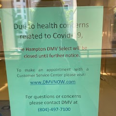
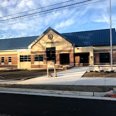
Hampton DMV Select Office
Virginia Beach Police Department - Fourth Precinct

Historic City Hall
Transit and Meeting Points
Useful pickup, handoff, or rendezvous points close to Virginia Beach.
Virginia Beach, Virginia
Norfolk
Newport News station
Williamsburg Transportation Center
Flight Path Map
This map shows the direct air route between Cape Charles and Portsmouth Heights. Straight-line distance: 36.61 mi (58.92 km).

#1 Cape Charles
Town in Virginia, United States
| Population | 1,056 |
| Coordinates | 37.2700800, -76.0164900 |
| Altitude | 1 |
| Country | United States |
#2 Portsmouth Heights
A census-designated place in Newport News, Virginia.
| Population | 99,049 |
| Coordinates | 36.8209800, -76.3688300 |
| Altitude | 3 |
| Country | United States |
End: Vick Street (-76.368598, 36.821321)
Estimated Travel Time
Distance: 80 km by road
| Speed | Time |
|---|---|
| 30 mph (48.3 km/h) | 01h 38m |
| 40 mph (64.37 km/h) | 01h 14m |
| 50 mph (80.47 km/h) | 00h 59m |
| 60 mph (96.56 km/h) | 00h 49m |
| 70 mph (112.65 km/h) | 00h 42m |
| 80 mph (129 km/h) | 00h 37m |
Fuel, Round Trip and CO2
Estimated fuel cost and emissions for this route.
| Fuel | $/gal | One way | Round trip |
|---|---|---|---|
| Regular gas | $3.96 | $6.93 | $13.86 |
| Mid-grade | $4.43 | $7.75 | $15.50 |
| Premium | $4.78 | $8.36 | $16.72 |
| Diesel | $5.62 | $9.84 | $19.68 |
Assumes 8.3 L/100 km (about 28.3 MPG). CO2 is an estimate and varies by vehicle, fuel blend, traffic, and terrain.
Prices in Virginia · Jul 18, 2026
Distance to Other Cities
Planning a road trip? See the full trip guide on Trip.ovh — stops, fuel costs, weather, and departure timing.