How far is Cambria, CA from San Diego, CA?
The driving distance from Cambria, CA to San Diego, CA is about 361.6 miles (582 km), with a travel time of about 06h 17m by car.
- The straight-line flight distance is about 298.1 miles (479.7 km).
- For a round trip, plan for roughly 12h 35m of driving time before adding stops, traffic, or weather delays.
- A comfortable departure window is usually 6:00 AM to 7:30 AM PDT.
Reverse, save, or send this route
This drive is better planned with a longer stop or an overnight stay. Copy the route link, send it to another device, or print a clean version before you head out.
This drive is better planned with a longer stop or an overnight stay.
Flight Distance
Driving Distance
Gas Cost Calculator
Leave and Arrive Planner
Pick a departure time to see your estimated arrival and same-day return window.
Drive time stays fixed at 06h 17m.
Starting early still helps, but most travelers will want a longer stop or an overnight stay on a route this long.
You are leaving earlier than the recommended window, which gives you extra margin for breaks and traffic.
Halfway Point
A useful midpoint for breaks, coffee, or meeting in the middle.
The most populous city in Ventura County, California.
Route Weather Snapshot
Check the forecast at both ends before you head out.
Mostly Clear
Mostly Cloudy
Driving Route Map
The map below follows the saved road route between Cambria and San Diego.
Turn-by-Turn Driving Directions
Step-by-step road directions between Cambria and San Diego.
-
1
Start on Village Lane
550 ft · 25 sec · Village Lane
-
2
Continue on Village Lane
823 ft · 45 sec · Village Lane
-
3
Turn left onto Burton Drive
2139 ft · 1 min · Burton Drive
-
4
Continue on Eton Road
1932 ft · 48 sec · Eton Road
-
5
At the end of the road, turn right onto Main Street
1085 ft · 27 sec · Main Street
-
6
Turn left onto Cabrillo Highway
29.9 mi · 38 min · Cabrillo Highway
-
7
Continue on North Santa Rosa Street
1.7 mi · 3 min · North Santa Rosa Street
-
8
Turn right onto Olive Street
1013 ft · 36 sec · Olive Street
-
9
Merge slight left onto Cabrillo Highway
11.6 mi · 13 min · Cabrillo Highway
-
10
Continue on El Camino Real
44.8 mi · 52 min · El Camino Real
-
11
Take the exit slight right toward CA 154: Los Olivos, Lake Cachuma
1266 ft · 39 sec
-
12
Turn left onto Chumash Highway
6.4 mi · 10 min · Chumash Highway
-
13
Enter the roundabout and take exit 2 toward Chumash Highway
39 m · 2 sec · Chumash Highway
-
14
Exit the roundabout onto Chumash Highway
2.2 mi · 3 min · Chumash Highway
-
15
Enter the roundabout and take exit 2 toward Chumash Highway
35 m · 2 sec · Chumash Highway
-
16
Exit the roundabout onto Chumash Highway
23.9 mi · 33 min · Chumash Highway
-
17
Take the ramp slight left toward US 101 South
1206 ft · 32 sec
-
18
Merge slight left onto El Camino Real
17 mi · 20 min · El Camino Real
-
19
Continue on Ventura Freeway
65.2 mi · 1 hr 15 min · Ventura Freeway
-
20
Take the exit slight right toward I 405 North, I 405 South: Sacramento, Santa Monica
758 ft · 19 sec
-
21
Keep slight right to continue on I 405 South: San Diego Freeway, Santa Monica
1584 ft · 39 sec
-
22
Keep slight left to continue on I 405 South: San Diego Freeway
553 ft · 14 sec
-
23
Merge slight left onto San Diego Freeway
13.3 mi · 15 min · San Diego Freeway
-
24
Keep slight right to continue on San Diego Freeway
26.5 mi · 31 min · San Diego Freeway
-
25
Keep slight right to continue on San Diego Freeway
2.3 mi · 3 min · San Diego Freeway
-
26
Keep slight left to continue on San Diego Freeway
893 ft · 12 sec · San Diego Freeway
-
27
Keep slight left
10.3 mi · 12 min
-
28
Keep slight right to continue on Corona Del Mar Freeway
4 mi · 5 min · Corona Del Mar Freeway
-
29
Continue on San Joaquin Hills Transportation Corridor
10.3 mi · 12 min · San Joaquin Hills Transportation Corridor
-
30
Take the exit slight right toward La Paz Road, Moulton Parkway
133 m · 6 sec
-
31
Keep slight left to continue on CA 73 South: Moulton Parkway
2519 ft · 33 sec
-
32
Keep slight left to continue on CA 73 South
3218 ft · 42 sec
-
33
Merge slight left onto San Joaquin Hills Transportation Corridor
2.5 mi · 3 min · San Joaquin Hills Transportation Corridor
-
34
Merge slight left onto San Diego Freeway
67.8 mi · 1 hr 19 min · San Diego Freeway
-
35
Take the exit slight right toward Front Street, Civic Center, 2nd Avenue
1164 ft · 28 sec
-
36
Keep slight right to continue on Front Street, Civic Center
592 ft · 15 sec
-
37
Continue on Front Street
2662 ft · 2 min · Front Street
-
38
Arrive at your destination
0 m · 1 sec · Front Street
Car Route Details
A richer read on the saved driving route between Cambria and San Diego.
Long-distance drive
This route is long enough that fuel, rest stops, weather, and timing matter more than any single maneuver.
San Diego Freeway
Merge slight left onto San Diego Freeway
67.8 mi · 01h 19m
Route Summary
A quick read on whether this route feels easy, ambitious, or worth planning around.
Better with a longer stop
This route is long enough that most travelers will be better off planning an overnight stay or a more deliberate stop window.
Mostly Clear leaving Cambria and Mostly Cloudy near San Diego.
Trip Questions
Direct answers travelers usually want before committing to the drive.
How long does it take to drive from Cambria to San Diego?
The road trip is about 361.6 miles (582 km) and usually takes 06h 17m in normal driving conditions.
Is this a same-day trip or an overnight route?
This route is long enough that most travelers will be better off planning an overnight stay or a more deliberate stop window.
What is the halfway point on this route?
Camarillo is a useful midpoint, sitting about 172.2 miles from Cambria and 189.4 miles from San Diego.
How much longer is the road route than the straight-line distance?
The direct path is about 298.1 miles (479.7 km), while the road route adds roughly 63.5 extra miles because roads do not follow the straight air line.
When is the best time to leave for this route?
A good departure window is usually 6:00 AM to 7:30 AM PDT. Starting early still helps, but most travelers will want a longer stop or an overnight stay on a route this long.
How much will gas cost for this route?
Using about 28.3 MPG, regular gas is estimated at $73.61 one way or $147.22 round trip. Estimated CO2 is about 113.4 kg one way.
What should you check before leaving?
Before you leave, expect Mostly Clear around Cambria and Mostly Cloudy near San Diego.
Stop Ideas Near Camarillo
Useful break, food, and waypoint ideas within about 15 miles of the route midpoint.
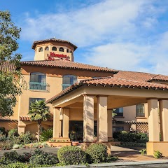
Hampton Inn & Suites Camarillo

Permanent Household Hazardous Waste Facility - City of Thousand Oaks

Santa Paula City Hall
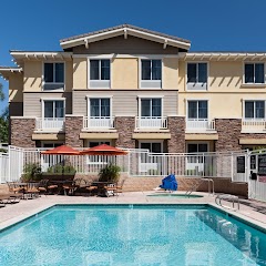
Homewood Suites by Hilton Agoura Hills
Transit and Meeting Points
Useful pickup, handoff, or rendezvous points close to Camarillo.
Camarillo station
Oxnard Transportation Center
Santa Paula, California
Moorpark
Flight Path Map
This map shows the direct air route between Cambria and San Diego. Straight-line distance: 298.08 mi (479.72 km).

#1 Cambria
Census designated place
| Population | 6,032 |
| Coordinates | 35.5641400, -121.0807500 |
| Altitude | 13 |
| Country | United States |

#2 San Diego
The eighth most populous city in the United States and the center of the San Diego metropolitan area.
| Population | 1,422,420 |
| Coordinates | 32.7157100, -117.1647200 |
| Altitude | 20 |
| Country | United States |
End: Front Street (-117.164717, 32.71571)
Estimated Travel Time
Distance: 582 km by road
| Speed | Time |
|---|---|
| 30 mph (48.3 km/h) | 12h 02m |
| 40 mph (64.37 km/h) | 09h 02m |
| 50 mph (80.47 km/h) | 07h 13m |
| 60 mph (96.56 km/h) | 06h 01m |
| 70 mph (112.65 km/h) | 05h 09m |
| 80 mph (129 km/h) | 04h 30m |
Fuel, Round Trip and CO2
Estimated fuel cost and emissions for this route.
| Fuel | $/gal | One way | Round trip |
|---|---|---|---|
| Regular gas | $5.77 | $73.61 | $147.22 |
| Mid-grade | $6.07 | $77.40 | $154.80 |
| Premium | $6.24 | $79.66 | $159.32 |
| Diesel | $7.57 | $96.55 | $193.11 |
Assumes 8.3 L/100 km (about 28.3 MPG). CO2 is an estimate and varies by vehicle, fuel blend, traffic, and terrain.
Prices in California · Jun 10, 2026
Distance to Other Cities
Planning a road trip? See the full trip guide on Trip.ovh — stops, fuel costs, weather, and departure timing.