How far is Beachwood, OH from Lorain, OH?
Fastest route
Here are some tips and suggestions for your trip from Beachwood, Ohio (44122) to Lorain, Ohio:
Directions
-
🚗 Get on I-271 S/US-422 E from Chagrin Blvd:
- Head north toward Chagrin Blvd.
- Turn left toward Chagrin Blvd.
- Turn left onto Chagrin Blvd.
- Slight right to merge onto I-271 S/US-422 E.
-
🛣️ Take I-480 W and I-90 W to OH-611 W/Colorado Ave in Avon:
- Merge onto I-480 W toward Toledo.
- Keep left to stay on I-480 W.
- Keep right at the fork to stay on I-480 W.
- Use the right 2 lanes to take exit 17A-B for OH-176 toward OH-17/Cleveland/Brookpark Road.
- Keep left to continue on Exit 17A, follow signs for OH-176 N.
- Use any lane to take the I-90 W/I-490 E exit.
- Take exit 151 for OH-611 toward Sheffield/Avon.
-
🗺️ Continue on OH-611 W/Colorado Ave. Drive to Hamilton Ave in Lorain:
- Use the right 2 lanes to turn right onto OH-611 W/Colorado Ave.
- Turn left onto Henderson Dr.
- Pass by Advance Auto Parts (on the right in 1.2 mi).
- Turn right onto Hamilton Ave.
Tips & Suggestions
- 🚦 Before starting your journey, check for traffic conditions on I-90 W using Google Maps or a similar app.
- 🍽️ Plan a stop for refreshments or meals along the route, possibly in Avon or another town you'll pass through.
- ⛽ Make sure your vehicle has enough fuel for the journey, as it's approximately 44.0 miles (about 70.8 kilometers) long.
- 🚘 Take note of any toll roads or toll booths on your route and prepare cash or electronic payment methods if needed.
- 🚧 Stay updated on road closures or construction works that may affect your trip. Consider alternate routes if necessary.
- 🏨 If you plan to stay in Lorain, book accommodations in advance to ensure availability.
- 🕰️ Allow extra time for your journey in case of unexpected delays or to enjoy some scenic spots along the way.
Reverse, save, or send this route
This route works well as a day trip with time at the destination. Copy the route link, send it to another device, or print a clean version before you head out.
This route works well as a day trip with time at the destination.
Flight Distance
Driving Distance
Gas Cost Calculator
Leave and Arrive Planner
Pick a departure time to see your estimated arrival and same-day return window.
Drive time stays fixed at 00h 52m.
A morning start gives you useful time at the destination and keeps the return out of the late evening.
You are leaving earlier than the recommended window, which gives you extra margin for breaks and traffic.
Halfway Point
A useful midpoint for breaks, coffee, or meeting in the middle.
Route Weather Snapshot
Check the forecast at both ends before you head out.
Chance Showers And Thunderstorms
Showers And Thunderstorms Likely
Driving Route Map
The map below follows the saved road route between Beachwood and Lorain.
Turn-by-Turn Driving Directions
Step-by-step road directions between Beachwood and Lorain.
-
1
Start on the route
3 m · 5 sec
-
2
Turn right onto Chagrin Boulevard
3.3 mi · 6 min · Chagrin Boulevard
-
3
Continue on Kinsman Road
4 mi · 10 min · Kinsman Road
-
4
Turn left onto Opportunity Corridor
1972 ft · 55 sec · Opportunity Corridor
-
5
Continue on Troy Lee James Highway
2.7 mi · 4 min · Troy Lee James Highway
-
6
Merge slight right onto Northwest Freeway
18.6 mi · 23 min · Northwest Freeway
-
7
Take the exit slight right toward SR 611: Avon, Sheffield Village
1268 ft · 34 sec
-
8
Turn right onto Colorado Avenue
5.5 mi · 10 min · Colorado Avenue
-
9
Turn left onto Henderson Drive
1.2 mi · 2 min · Henderson Drive
-
10
Continue on West 21st Street
1.4 km · 2 min · West 21st Street
-
11
Turn right onto Hamilton Avenue
720 ft · 32 sec · Hamilton Avenue
-
12
Arrive at your destination
0 m · 1 sec · Hamilton Avenue
Car Route Details
A richer read on the saved driving route between Beachwood and Lorain.
Straightforward drive
The saved road route has a manageable number of maneuvers and should be easy to follow with normal attention to signs.
Northwest Freeway
Merge slight right onto Northwest Freeway
18.6 mi · 00h 23m
Route Summary
A quick read on whether this route feels easy, ambitious, or worth planning around.
A comfortable day-trip route
This route works well as a day trip. You can leave in the morning, spend meaningful time at the destination, and still return the same day.
Chance Showers And Thunderstorms leaving Beachwood and Showers And Thunderstorms Likely near Lorain.
Trip Questions
Direct answers travelers usually want before committing to the drive.
How long does it take to drive from Beachwood to Lorain?
The road trip is about 44.5 miles (71.6 km) and usually takes 00h 52m in normal driving conditions.
Is this a same-day trip or an overnight route?
This route works well as a day trip. You can leave in the morning, spend meaningful time at the destination, and still return the same day.
What is the halfway point on this route?
Rocky River is a useful midpoint, sitting about 18.4 miles from Beachwood and 26.1 miles from Lorain.
How much longer is the road route than the straight-line distance?
The direct path is about 34.9 miles (56.2 km), while the road route adds roughly 9.6 extra miles because roads do not follow the straight air line.
When is the best time to leave for this route?
A good departure window is usually 8:00 AM to 10:00 AM EDT. If you want a more comfortable same-day return, try to leave by 4:44 PM EDT.
How much will gas cost for this route?
Using about 28.3 MPG, regular gas is estimated at $5.82 one way or $11.63 round trip. Estimated CO2 is about 14 kg one way.
What should you check before leaving?
Before you leave, expect Chance Showers And Thunderstorms around Beachwood and Showers And Thunderstorms Likely near Lorain.
Stop Ideas Near Rocky River
Useful break, food, and waypoint ideas within about 15 miles of the route midpoint.

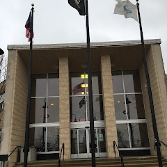
Cleveland City Hall
Parma City Hall
Transit and Meeting Points
Useful pickup, handoff, or rendezvous points close to Rocky River.
Cleveland Lakefront station
Elyria
Sandusky
Alliance
Flight Path Map
This map shows the direct air route between Beachwood and Lorain. Straight-line distance: 34.89 mi (56.15 km).

#1 Beachwood
City in Ohio
| Population | 11,543 |
| Coordinates | 41.4645000, -81.5087300 |
| Altitude | 361 |
| Country | United States |

#2 Lorain
The most populous city in Lorain County, Ohio.
| Population | 63,872 |
| Coordinates | 41.4528200, -82.1823700 |
| Altitude | 186 |
| Country | United States |
End: Hamilton Avenue (-82.182237, 41.452819)
Estimated Travel Time
Distance: 72 km by road
| Speed | Time |
|---|---|
| 30 mph (48.3 km/h) | 01h 28m |
| 40 mph (64.37 km/h) | 01h 06m |
| 50 mph (80.47 km/h) | 00h 53m |
| 60 mph (96.56 km/h) | 00h 44m |
| 70 mph (112.65 km/h) | 00h 38m |
| 80 mph (129 km/h) | 00h 33m |
Fuel, Round Trip and CO2
Estimated fuel cost and emissions for this route.
| Fuel | $/gal | One way | Round trip |
|---|---|---|---|
| Regular gas | $3.71 | $5.82 | $11.63 |
| Mid-grade | $4.24 | $6.66 | $13.32 |
| Premium | $4.79 | $7.52 | $15.04 |
| Diesel | $4.30 | $6.76 | $13.51 |
Assumes 8.3 L/100 km (about 28.3 MPG). CO2 is an estimate and varies by vehicle, fuel blend, traffic, and terrain.
Prices in Ohio · Jun 10, 2026
Distance to Other Cities
Planning a road trip? See the full trip guide on Trip.ovh — stops, fuel costs, weather, and departure timing.