How far is Bangor, NY from Buffalo, NY?
The driving distance from Bangor, NY to Buffalo, NY is about 315.7 miles (508 km), with a travel time of about 05h 24m by car.
- The straight-line flight distance is about 259.9 miles (418.2 km).
- For a round trip, plan for roughly 10h 48m of driving time before adding stops, traffic, or weather delays.
- A comfortable departure window is usually 6:00 AM to 8:00 AM EDT.
Reverse, save, or send this route
This drive is better planned with a longer stop or an overnight stay. Copy the route link, send it to another device, or print a clean version before you head out.
This drive is better planned with a longer stop or an overnight stay.
Flight Distance
Driving Distance
Gas Cost Calculator
Leave and Arrive Planner
Pick a departure time to see your estimated arrival and same-day return window.
Drive time stays fixed at 05h 24m.
An early departure helps you fit a real stop into the day without turning the return into a late-night drive.
This departure sits inside the recommended comfort window for the route.
Halfway Point
A useful midpoint for breaks, coffee, or meeting in the middle.
City in New York, United States of America
Route Weather Snapshot
Check the forecast at both ends before you head out.
Showers And Thunderstorms
Showers And Thunderstorms
Driving Route Map
The map below follows the saved road route between Bangor and Buffalo.
Turn-by-Turn Driving Directions
Step-by-step road directions between Bangor and Buffalo.
-
1
Start on the route
31.7 mi · 49 min
-
2
At the end of the road, turn left onto Market Street
128 m · 16 sec · Market Street
-
3
Turn right onto Maple Street
2058 ft · 1 min · Maple Street
-
4
Turn slight right onto Clarkson Avenue
45 m · 10 sec · Clarkson Avenue
-
5
Turn left onto Sandstone Drive
575 ft · 16 sec · Sandstone Drive
-
6
Continue on Maple Street
10.6 mi · 16 min · Maple Street
-
7
Turn left onto Gouverneur Street
24.7 mi · 28 min · Gouverneur Street
-
8
Continue on Preston Street
27 mi · 31 min · Preston Street
-
9
Take the exit slight right toward I 781 West
1362 ft · 33 sec
-
10
Continue straight
4 mi · 4 min
-
11
Keep slight left to continue on I 81 South: Watertown
1.1 km · 1 min
-
12
Merge slight left
64.7 mi · 1 hr 15 min
-
13
Keep slight right
2721 ft · 33 sec
-
14
Continue straight
4.2 mi · 5 min
-
15
Take the exit slight right toward I 90: Albany, Buffalo
2487 ft · 1 min
-
16
Keep slight right to continue on I 90 West: Buffalo
803 ft · 20 sec
-
17
Merge slight left onto New York State Thruway
138.1 mi · 2 hr 40 min · New York State Thruway
-
18
Take the exit slight right toward NY 33 West: Buffalo
1901 ft · 46 sec
-
19
Merge slight left onto Kensington Expressway
6.4 mi · 9 min · Kensington Expressway
-
20
Keep slight left to continue on Oak Street
2170 ft · 40 sec
-
21
Continue on Oak Street
131 m · 14 sec · Oak Street
-
22
Turn right onto Genesee Street
1172 ft · 39 sec · Genesee Street
-
23
Turn right onto East Huron Street
729 ft · 34 sec · East Huron Street
-
24
Turn left onto Franklin Street
716 ft · 23 sec · Franklin Street
-
25
Turn right onto Genesee Street
123 m · 12 sec · Genesee Street
-
26
Enter the roundabout toward Niagara Square
119 m · 12 sec · Niagara Square
-
27
Arrive at your destination
0 m · 1 sec · Niagara Square
Car Route Details
A richer read on the saved driving route between Bangor and Buffalo.
Long-distance drive
This route is long enough that fuel, rest stops, weather, and timing matter more than any single maneuver.
New York State Thruway
Merge slight left onto New York State Thruway
138 mi · 02h 40m
Route Summary
A quick read on whether this route feels easy, ambitious, or worth planning around.
A longer out-and-back drive
This is still possible in one day, but it becomes a long driving day. Leaving early and planning your stop window matters more here.
Showers And Thunderstorms leaving Bangor and Showers And Thunderstorms near Buffalo.
Trip Questions
Direct answers travelers usually want before committing to the drive.
How long does it take to drive from Bangor to Buffalo?
The road trip is about 315.7 miles (508 km) and usually takes 05h 24m in normal driving conditions.
Is this a same-day trip or an overnight route?
This is still possible in one day, but it becomes a long driving day. Leaving early and planning your stop window matters more here.
What is the halfway point on this route?
Brewerton is a useful midpoint, sitting about 157.5 miles from Bangor and 158.2 miles from Buffalo.
How much longer is the road route than the straight-line distance?
The direct path is about 259.9 miles (418.2 km), while the road route adds roughly 55.8 extra miles because roads do not follow the straight air line.
When is the best time to leave for this route?
A good departure window is usually 6:00 AM to 8:00 AM EDT. If you want a more comfortable same-day return, try to leave by 6:12 AM EDT.
How much will gas cost for this route?
Using about 28.3 MPG, regular gas is estimated at $44.66 one way or $89.32 round trip. Estimated CO2 is about 99 kg one way.
What should you check before leaving?
Before you leave, expect Showers And Thunderstorms around Bangor and Showers And Thunderstorms near Buffalo.
Stop Ideas Near Brewerton
Useful break, food, and waypoint ideas within about 15 miles of the route midpoint.
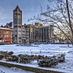
City Hall Cafe
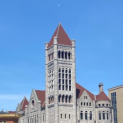
Syracuse City Hall
Transit and Meeting Points
Useful pickup, handoff, or rendezvous points close to Brewerton.
William F. Walsh Regional Transportation Center
Empire Expo Center
Rome station
Union Station
Flight Path Map
This map shows the direct air route between Bangor and Buffalo. Straight-line distance: 259.86 mi (418.21 km).
#1 Bangor
Town in the state of New York, USA
| Population | 2,249 |
| Coordinates | 44.8122700, -74.3974000 |
| Altitude | 234 |
| Country | United States |

#2 Buffalo
The second most populous city in New York.
| Population | 254,479 |
| Coordinates | 42.8864500, -78.8783700 |
| Altitude | 183 |
| Country | United States |
End: Niagara Square (-78.878786, 42.886515)
Estimated Travel Time
Distance: 508 km by road
| Speed | Time |
|---|---|
| 30 mph (48.3 km/h) | 10h 31m |
| 40 mph (64.37 km/h) | 07h 53m |
| 50 mph (80.47 km/h) | 06h 18m |
| 60 mph (96.56 km/h) | 05h 15m |
| 70 mph (112.65 km/h) | 04h 30m |
| 80 mph (129 km/h) | 03h 56m |
Fuel, Round Trip and CO2
Estimated fuel cost and emissions for this route.
| Fuel | $/gal | One way | Round trip |
|---|---|---|---|
| Regular gas | $4.01 | $44.66 | $89.32 |
| Mid-grade | $4.48 | $49.92 | $99.84 |
| Premium | $4.86 | $54.15 | $108.30 |
| Diesel | $4.69 | $52.29 | $104.58 |
Assumes 8.3 L/100 km (about 28.3 MPG). CO2 is an estimate and varies by vehicle, fuel blend, traffic, and terrain.
Prices in New York · Jun 10, 2026
Distance to Other Cities
Planning a road trip? See the full trip guide on Trip.ovh — stops, fuel costs, weather, and departure timing.