How far is Bakersfield, CA from Oceanside, CA?
The driving distance from Bakersfield, CA to Oceanside, CA is about 195.7 miles (315 km), with a travel time of about 03h 50m by car.
- The straight-line flight distance is about 177.2 miles (285.1 km).
- For a round trip, plan for roughly 07h 41m of driving time before adding stops, traffic, or weather delays.
- A comfortable departure window is usually 6:00 AM to 8:00 AM PDT.
Reverse, save, or send this route
This drive is better planned with a longer stop or an overnight stay. Copy the route link, send it to another device, or print a clean version before you head out.
This drive is better planned with a longer stop or an overnight stay.
Flight Distance
Driving Distance
Gas Cost Calculator
Leave and Arrive Planner
Pick a departure time to see your estimated arrival and same-day return window.
Drive time stays fixed at 03h 50m.
An early departure helps you fit a real stop into the day without turning the return into a late-night drive.
You are leaving earlier than the recommended window, which gives you extra margin for breaks and traffic.
Halfway Point
A useful midpoint for breaks, coffee, or meeting in the middle.
The most populous city in Los Angeles County, California.
Route Weather Snapshot
Check the forecast at both ends before you head out.
Patchy Fog then Mostly Sunny
Driving Route Map
The map below follows the saved road route between Bakersfield and Oceanside.
Turn-by-Turn Driving Directions
Step-by-step road directions between Bakersfield and Oceanside.
-
1
Start on Truxtun Avenue
670 ft · 20 sec · Truxtun Avenue
-
2
Turn right onto L Street
1710 ft · 51 sec · L Street
-
3
Turn right onto California Avenue
1.5 mi · 2 min · California Avenue
-
4
Take the ramp slight right toward CA 99 South
1049 ft · 26 sec
-
5
Merge slight left onto Golden State Freeway
24.7 mi · 27 min · Golden State Freeway
-
6
Keep slight left to continue on Golden State Freeway
58.2 mi · 1 hr 7 min · Golden State Freeway
-
7
Keep slight left to continue on Golden State Freeway
4.1 mi · 5 min · Golden State Freeway
-
8
Keep slight right to continue on I 405 South
1354 ft · 18 sec
-
9
Keep slight left
24.7 mi · 29 min
-
10
Keep slight left to continue on Golden State Freeway
1.3 mi · 2 min · Golden State Freeway
-
11
Merge slight left onto Santa Ana Freeway
25.7 mi · 30 min · Santa Ana Freeway
-
12
Keep slight right to continue on Santa Ana Freeway
1241 ft · 16 sec · Santa Ana Freeway
-
13
Take the exit slight right toward Broadway, Main Street, Santa Ana
1.3 km · 57 sec
-
14
Keep slight left
788 ft · 10 sec
-
15
Keep slight left to continue on I 5 South
981 ft · 13 sec
-
16
Merge slight left onto Santa Ana Freeway
1.3 km · 54 sec · Santa Ana Freeway
-
17
Keep slight right to continue on Santa Ana Freeway
1.2 km · 52 sec · Santa Ana Freeway
-
18
Keep slight right to continue on Santa Ana Freeway
1.2 mi · 1 min · Santa Ana Freeway
-
19
Take the exit slight right toward Newport Avenue
1.2 km · 1 min
-
20
Turn right onto Newport Avenue
1943 ft · 44 sec · Newport Avenue
-
21
Turn left onto Walnut Avenue
2.2 mi · 4 min · Walnut Avenue
-
22
Turn left onto Jamboree Road
2595 ft · 38 sec · Jamboree Road
-
23
Take the exit slight right toward I 5 South
1479 ft · 21 sec
-
24
Merge slight left onto Santa Ana Freeway
5.5 mi · 6 min · Santa Ana Freeway
-
25
Keep slight left to continue on Santa Ana Freeway
1.3 km · 56 sec · Santa Ana Freeway
-
26
Merge slight right onto San Diego Freeway
39.3 mi · 45 min · San Diego Freeway
-
27
Take the exit slight right toward Coast Highway
1490 ft · 36 sec
-
28
Merge slight left onto San Luis Rey Mission Expressway
645 ft · 16 sec · San Luis Rey Mission Expressway
-
29
Turn left onto North Coast Highway
95 m · 11 sec · North Coast Highway
-
30
Continue on Pacific Coast Highway
2221 ft · 1 min · Pacific Coast Highway
-
31
Arrive at your destination
0 m · 1 sec · Pacific Coast Highway
Car Route Details
A richer read on the saved driving route between Bakersfield and Oceanside.
Highway-focused drive
Most of the mileage stays on named highways, so the important moments are ramps, exits, merges, and the final local approach.
Golden State Freeway
Keep slight left to continue on Golden State Freeway
58.2 mi · 01h 07m
Route Summary
A quick read on whether this route feels easy, ambitious, or worth planning around.
A longer out-and-back drive
This is still possible in one day, but it becomes a long driving day. Leaving early and planning your stop window matters more here.
Sunny leaving Bakersfield and Patchy Fog then Mostly Sunny near Oceanside.
Trip Questions
Direct answers travelers usually want before committing to the drive.
How long does it take to drive from Bakersfield to Oceanside?
The road trip is about 195.7 miles (315 km) and usually takes 03h 50m in normal driving conditions.
Is this a same-day trip or an overnight route?
This is still possible in one day, but it becomes a long driving day. Leaving early and planning your stop window matters more here.
What is the halfway point on this route?
Burbank is a useful midpoint, sitting about 97.9 miles from Bakersfield and 97.8 miles from Oceanside.
How much longer is the road route than the straight-line distance?
The direct path is about 177.2 miles (285.1 km), while the road route adds roughly 18.5 extra miles because roads do not follow the straight air line.
When is the best time to leave for this route?
A good departure window is usually 6:00 AM to 8:00 AM PDT. If you want a more comfortable same-day return, try to leave by 9:18 AM PDT.
How much will gas cost for this route?
Using about 28.3 MPG, regular gas is estimated at $39.86 one way or $79.73 round trip. Estimated CO2 is about 61.4 kg one way.
What should you check before leaving?
Before you leave, expect Sunny around Bakersfield and Patchy Fog then Mostly Sunny near Oceanside.
Stop Ideas Near Burbank
Useful break, food, and waypoint ideas within about 15 miles of the route midpoint.

The Beverly Hilton

City Hall Park Center
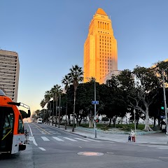
City of Los Angeles
City Hall South
Transit and Meeting Points
Useful pickup, handoff, or rendezvous points close to Burbank.
Burbank Airport–South station
La Crescenta, California
Glendale Transportation Center
Van Nuys station
Flight Path Map
This map shows the direct air route between Bakersfield and Oceanside. Straight-line distance: 177.17 mi (285.12 km).

#1 Bakersfield
The fifth most populous city in California and the center of the Bakersfield metropolitan area.
| Population | 385,725 |
| Coordinates | 35.3732900, -119.0187100 |
| Altitude | 123 |
| Country | United States |

#2 Oceanside
The second most populous city in San Diego County, California.
| Population | 174,648 |
| Coordinates | 33.1958700, -117.3794800 |
| Altitude | 20 |
| Country | United States |
End: Oceanside (-117.37948, 33.19587)
Estimated Travel Time
Distance: 315 km by road
| Speed | Time |
|---|---|
| 30 mph (48.3 km/h) | 06h 31m |
| 40 mph (64.37 km/h) | 04h 53m |
| 50 mph (80.47 km/h) | 03h 54m |
| 60 mph (96.56 km/h) | 03h 15m |
| 70 mph (112.65 km/h) | 02h 47m |
| 80 mph (129 km/h) | 02h 26m |
Fuel, Round Trip and CO2
Estimated fuel cost and emissions for this route.
| Fuel | $/gal | One way | Round trip |
|---|---|---|---|
| Regular gas | $5.77 | $39.86 | $79.73 |
| Mid-grade | $6.07 | $41.92 | $83.83 |
| Premium | $6.24 | $43.14 | $86.28 |
| Diesel | $7.57 | $52.29 | $104.58 |
Assumes 8.3 L/100 km (about 28.3 MPG). CO2 is an estimate and varies by vehicle, fuel blend, traffic, and terrain.
Prices in California · Jun 10, 2026
Distance to Other Cities
Planning a road trip? See the full trip guide on Trip.ovh — stops, fuel costs, weather, and departure timing.