How far is Babylon, NY from Stephentown, NY?
The driving distance from Babylon, NY to Stephentown, NY is about 170.8 miles (274.9 km), with a travel time of about 04h 00m by car.
- The straight-line flight distance is about 128.1 miles (206.1 km).
- For a round trip, plan for roughly 08h 00m of driving time before adding stops, traffic, or weather delays.
- A comfortable departure window is usually 6:00 AM to 8:00 AM EDT.
Reverse, save, or send this route
This drive is better planned with a longer stop or an overnight stay. Copy the route link, send it to another device, or print a clean version before you head out.
This drive is better planned with a longer stop or an overnight stay.
Flight Distance
Driving Distance
Gas Cost Calculator
Leave and Arrive Planner
Pick a departure time to see your estimated arrival and same-day return window.
Drive time stays fixed at 04h 00m.
An early departure helps you fit a real stop into the day without turning the return into a late-night drive.
You are leaving earlier than the recommended window, which gives you extra margin for breaks and traffic.
Halfway Point
A useful midpoint for breaks, coffee, or meeting in the middle.
Census-designated place in Putnam County, New York
Route Weather Snapshot
Check the forecast at both ends before you head out.
Sunny
Mostly Sunny
Driving Route Map
The map below follows the saved road route between Babylon and Stephentown.
Turn-by-Turn Driving Directions
Step-by-step road directions between Babylon and Stephentown.
-
1
Start on South Carll Avenue
21 m · 11 sec · South Carll Avenue
-
2
Turn left onto West Main Street
2483 ft · 51 sec · West Main Street
-
3
Turn right onto Little East Neck Road North
1.4 km · 2 min · Little East Neck Road North
-
4
Continue on Farmingdale Road
3.6 mi · 6 min · Farmingdale Road
-
5
Take the ramp slight right toward SO West: New York
965 ft · 25 sec
-
6
Merge slight left onto Southern State Parkway
17.9 mi · 22 min · Southern State Parkway
-
7
Take the exit slight right toward Cross Island Parkway North, Whitestone Bridge
1780 ft · 43 sec
-
8
Merge slight left onto Cross Island Parkway
1.3 mi · 2 min · Cross Island Parkway
-
9
Take the exit slight right toward NY 24: UBS Arena-Belmont Park
97 m · 9 sec
-
10
Keep slight left to continue on NY 24 West: Hempstead Avenue
133 m · 12 sec
-
11
Keep slight right to continue on Cross Island Parkway North, Hempstead Avenue West
532 ft · 15 sec
-
12
Keep slight right to continue on Hempstead Avenue West
81 m · 8 sec
-
13
Continue on Grandstand, Hempstead Avenue West
549 ft · 14 sec
-
14
Keep slight left to continue on Hempstead Avenue
31 m · 5 sec
-
15
Turn right onto Hempstead Avenue
1.6 km · 2 min · Hempstead Avenue
-
16
Turn left onto Jamaica Avenue
553 ft · 17 sec · Jamaica Avenue
-
17
Turn right onto 212th Street
1.2 km · 1 min · 212th Street
-
18
Continue on Clearview Expressway
5 mi · 5 min · Clearview Expressway
-
19
Continue on Throgs Neck Bridge
2 mi · 3 min · Throgs Neck Bridge
-
20
Continue on Throgs Neck Expressway
1.1 km · 1 min · Throgs Neck Expressway
-
21
Keep slight right to continue on Throgs Neck Expressway
1.8 mi · 3 min · Throgs Neck Expressway
-
22
Merge slight right onto Bruckner Expressway
1 mi · 2 min · Bruckner Expressway
-
23
Continue on New England Thruway
1074 ft · 18 sec · New England Thruway
-
24
Take the exit slight right toward Hutchinson Parkway North
131 m · 15 sec
-
25
Keep slight left to continue on Hutchinson River Parkway North
912 ft · 31 sec
-
26
Merge slight left onto Hutchinson River Parkway
13.5 mi · 19 min · Hutchinson River Parkway
-
27
Keep slight left to continue on I 684 North: Brewster
1.6 mi · 2 min
-
28
Merge slight right
26.2 mi · 30 min
-
29
Continue straight
1.3 mi · 2 min
-
30
Continue straight
43.2 mi · 1 hr 6 min
-
31
Turn straight onto State Highway 22
23.4 mi · 32 min · State Highway 22
-
32
Continue on State Route 22
3.9 mi · 5 min · State Route 22
-
33
Continue on State Route 22
12.9 mi · 18 min · State Route 22
-
34
At the end of the road, turn right onto Columbia Pike
1.2 km · 1 min · Columbia Pike
-
35
Turn left onto State Highway 22
37 m · 3 sec · State Highway 22
-
36
Continue on NY 22
1.2 km · 1 min · NY 22
-
37
Continue on East Street
2.2 mi · 3 min · East Street
-
38
Continue on NY 22
3 mi · 4 min · NY 22
-
39
Turn slight left onto State Highway 43
1474 ft · 32 sec · State Highway 43
-
40
Arrive at your destination
0 m · 1 sec · State Highway 43
Car Route Details
A richer read on the saved driving route between Babylon and Stephentown.
Highway-focused drive
Most of the mileage stays on named highways, so the important moments are ramps, exits, merges, and the final local approach.
I 684 North
Continue straight
43.2 mi · 01h 06m
Route Summary
A quick read on whether this route feels easy, ambitious, or worth planning around.
A longer out-and-back drive
This is still possible in one day, but it becomes a long driving day. Leaving early and planning your stop window matters more here.
Sunny leaving Babylon and Mostly Sunny near Stephentown.
Trip Questions
Direct answers travelers usually want before committing to the drive.
How long does it take to drive from Babylon to Stephentown?
The road trip is about 170.8 miles (274.9 km) and usually takes 04h 00m in normal driving conditions.
Is this a same-day trip or an overnight route?
This is still possible in one day, but it becomes a long driving day. Leaving early and planning your stop window matters more here.
What is the halfway point on this route?
Putnam Lake is a useful midpoint, sitting about 85.4 miles from Babylon and 85.4 miles from Stephentown.
How much longer is the road route than the straight-line distance?
The direct path is about 128.1 miles (206.1 km), while the road route adds roughly 42.7 extra miles because roads do not follow the straight air line.
When is the best time to leave for this route?
A good departure window is usually 6:00 AM to 8:00 AM EDT. If you want a more comfortable same-day return, try to leave by 9:00 AM EDT.
How much will gas cost for this route?
Using about 28.3 MPG, regular gas is estimated at $24.17 one way or $48.35 round trip. Estimated CO2 is about 53.6 kg one way.
What should you check before leaving?
Before you leave, expect Sunny around Babylon and Mostly Sunny near Stephentown.
Stop Ideas Near Putnam Lake
Useful break, food, and waypoint ideas within about 15 miles of the route midpoint.

Danbury Fair
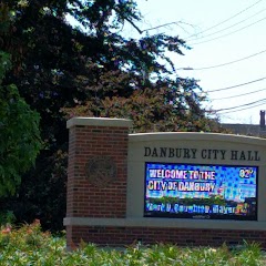
Danbury City Hall
Edmond Town Hall
Transit and Meeting Points
Useful pickup, handoff, or rendezvous points close to Putnam Lake.
Croton–Harmon station
Poughkeepsie station
Bridgeport
Stamford Transportation Center
Flight Path Map
This map shows the direct air route between Babylon and Stephentown. Straight-line distance: 128.06 mi (206.09 km).
#1 Babylon
A town in Suffolk County, New York.
| Population | 218,223 |
| Coordinates | 40.6956600, -73.3256800 |
| Altitude | 2 |
| Country | United States |

#2 Stephentown
City in Rensselaer County, New York, United States of America
| Population | 2,861 |
| Coordinates | 42.5486900, -73.3740000 |
| Altitude | 267 |
| Country | United States |
End: Stephentown (-73.374, 42.54869)
Estimated Travel Time
Distance: 275 km by road
| Speed | Time |
|---|---|
| 30 mph (48.3 km/h) | 05h 41m |
| 40 mph (64.37 km/h) | 04h 16m |
| 50 mph (80.47 km/h) | 03h 24m |
| 60 mph (96.56 km/h) | 02h 50m |
| 70 mph (112.65 km/h) | 02h 26m |
| 80 mph (129 km/h) | 02h 07m |
Fuel, Round Trip and CO2
Estimated fuel cost and emissions for this route.
| Fuel | $/gal | One way | Round trip |
|---|---|---|---|
| Regular gas | $4.01 | $24.17 | $48.35 |
| Mid-grade | $4.48 | $27.02 | $54.04 |
| Premium | $4.86 | $29.31 | $58.62 |
| Diesel | $4.69 | $28.30 | $56.61 |
Assumes 8.3 L/100 km (about 28.3 MPG). CO2 is an estimate and varies by vehicle, fuel blend, traffic, and terrain.
Prices in New York · Jul 14, 2026
Distance to Other Cities
Planning a road trip? See the full trip guide on Trip.ovh — stops, fuel costs, weather, and departure timing.