How far is Arlington, VA from Ashburn, VA?
Fastest route
The route from Arlington, Virginia, USA to Ashburn, Virginia, USA is approximately 27.3 miles and takes about 33 minutes via VA-267 W. The route has tolls.
Directions
- Get on I-66 W from Fairfax Dr.
- Head west on Wilson Blvd toward N Quincy St.
- Turn right onto N Quincy St.
- Turn left at the 2nd cross street onto Fairfax Dr.
- Use the right 2 lanes to merge onto I-66 W via the ramp to VA-267/I-495 S.
- Continue on I-66 W. Take VA-267 W to VA-625 W/Waxpool Rd in Ashburn. Take the VA-625 W/Waxpool Rd exit from VA-28 N (toll road).
- Merge onto VA-625 W/Waxpool Rd and continue to follow VA-625 W. Turn right onto State Rte 641.
Tips & Suggestions
- 🚗 Plan your trip in advance to account for any traffic conditions.
- 💰 Make sure to have some cash or an electronic payment method for the tolls along the route.
- 🛣️ Follow the signs for Dulles Airport and I-495 N/Baltimore.
- ⚠️ Pay attention to the exits and keep right when necessary.
- 🚦 Observe the road signs and be aware of any speed limits or other regulations.
- 📍 Use GPS or maps for real-time navigation assistance.
- 🚧 Be cautious of any ongoing road construction or detours that may affect the route.
Reverse, save, or send this route
This is an easy same-day return drive. Copy the route link, send it to another device, or print a clean version before you head out.
This is an easy same-day return drive.
Flight Distance
Driving Distance
Gas Cost Calculator
Leave and Arrive Planner
Pick a departure time to see your estimated arrival and same-day return window.
Drive time stays fixed at 00h 33m.
This is a short drive, so your comfort window is wide. Traffic and current weather matter more than the clock.
This departure sits inside the recommended comfort window for the route.
Halfway Point
A useful midpoint for breaks, coffee, or meeting in the middle.
Census designated place
Route Weather Snapshot
Check the forecast at both ends before you head out.
Smoke then Chance Showers And Thunderstorms
Areas Of Smoke then Patchy Smoke
Driving Route Map
The map below follows the saved road route between Arlington and Ashburn.
Turn-by-Turn Driving Directions
Step-by-step road directions between Arlington and Ashburn.
-
1
Start on Wilson Boulevard
2828 ft · 2 min · Wilson Boulevard
-
2
Turn slight right onto North Glebe Road
936 ft · 31 sec · North Glebe Road
-
3
Turn left onto Fairfax Drive
667 ft · 28 sec · Fairfax Drive
-
4
Continue on I 66 Toll West
2423 ft · 1 min
-
5
Merge slight left onto Custis Memorial Parkway
3.3 mi · 4 min · Custis Memorial Parkway
-
6
Keep slight right to continue on Dulles Toll Road
2.3 mi · 3 min · Dulles Toll Road
-
7
Keep slight right to continue on Dulles Toll Road
2.2 mi · 3 min · Dulles Toll Road
-
8
Keep slight left
1869 ft · 23 sec
-
9
Merge slight right onto Dulles Toll Road
10.2 mi · 14 min · Dulles Toll Road
-
10
Take the exit slight right toward VA 28 North: Sterling
1 km · 1 min
-
11
Merge slight left onto Sully Road
2.3 mi · 3 min · Sully Road
-
12
Take the exit slight left toward VA 625 West: Waxpool Road, Ashburn
1.2 km · 2 min
-
13
Turn straight onto Waxpool Road
1.7 mi · 3 min · Waxpool Road
-
14
Continue on Farmwell Road
1.3 mi · 2 min · Farmwell Road
-
15
Turn right onto Ashburn Road
1.2 mi · 3 min · Ashburn Road
-
16
Arrive at your destination
0 m · 1 sec · Ashburn Road
Car Route Details
A richer read on the saved driving route between Arlington and Ashburn.
Turn-heavy local drive
The route has frequent decision points for its length, so lane choice and turn timing will matter more than cruising speed.
Dulles Toll Road
Merge slight right onto Dulles Toll Road
10.2 mi · 00h 14m
Route Summary
A quick read on whether this route feels easy, ambitious, or worth planning around.
A short regional drive
This route is short enough to handle as a quick errand, commute, or easy same-day return without much planning overhead.
Smoke then Chance Showers And Thunderstorms leaving Arlington and Areas Of Smoke then Patchy Smoke near Ashburn.
Trip Questions
Direct answers travelers usually want before committing to the drive.
How long does it take to drive from Arlington to Ashburn?
The road trip is about 27.4 miles (44.1 km) and usually takes 00h 33m in normal driving conditions.
Is this a same-day trip or an overnight route?
This route is short enough to handle as a quick errand, commute, or easy same-day return without much planning overhead.
What is the halfway point on this route?
Wolf Trap is a useful midpoint, sitting about 13.7 miles from Arlington and 13.7 miles from Ashburn.
How much longer is the road route than the straight-line distance?
The direct path is about 23.5 miles (37.8 km), while the road route adds roughly 3.9 extra miles because roads do not follow the straight air line.
When is the best time to leave for this route?
A good departure window is usually 7:00 AM to 7:00 PM EDT. If you want a more comfortable same-day return, try to leave by 7:22 PM EDT.
How much will gas cost for this route?
Using about 28.3 MPG, regular gas is estimated at $3.84 one way or $7.68 round trip. Estimated CO2 is about 8.6 kg one way.
What should you check before leaving?
Before you leave, expect Smoke then Chance Showers And Thunderstorms around Arlington and Areas Of Smoke then Patchy Smoke near Ashburn.
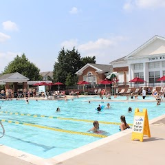
Stop Ideas Near Wolf Trap
Useful break, food, and waypoint ideas within about 15 miles of the route midpoint.

Griffith Park at City Hall

Tele-Town Hall
Manassas Park City Hall
Town Hall Pool
Transit and Meeting Points
Useful pickup, handoff, or rendezvous points close to Wolf Trap.
Burke Centre
Rockville station
Union Station
Washington Union Station
Flight Path Map
This map shows the direct air route between Arlington and Ashburn. Straight-line distance: 23.46 mi (37.75 km).

#1 Arlington
A county in Virginia.
| Population | 229,164 |
| Coordinates | 38.8810100, -77.1042800 |
| Altitude | 71 |
| Country | United States |
#2 Ashburn
Ashburn is a place in Virginia, United States.
| Population | 0 |
| Coordinates | 39.0437200, -77.4874900 |
| Altitude | 90 |
| Country | United States |
End: Ashburn Road (-77.487437, 39.043717)
Estimated Travel Time
Distance: 44 km by road
| Speed | Time |
|---|---|
| 30 mph (48.3 km/h) | 00h 54m |
| 40 mph (64.37 km/h) | 00h 41m |
| 50 mph (80.47 km/h) | 00h 32m |
| 60 mph (96.56 km/h) | 00h 27m |
| 70 mph (112.65 km/h) | 00h 23m |
| 80 mph (129 km/h) | 00h 20m |
Fuel, Round Trip and CO2
Estimated fuel cost and emissions for this route.
| Fuel | $/gal | One way | Round trip |
|---|---|---|---|
| Regular gas | $3.96 | $3.84 | $7.68 |
| Mid-grade | $4.43 | $4.30 | $8.59 |
| Premium | $4.78 | $4.63 | $9.27 |
| Diesel | $5.62 | $5.46 | $10.91 |
Assumes 8.3 L/100 km (about 28.3 MPG). CO2 is an estimate and varies by vehicle, fuel blend, traffic, and terrain.
Prices in Virginia · Jul 18, 2026
Distance to Other Cities
Planning a road trip? See the full trip guide on Trip.ovh — stops, fuel costs, weather, and departure timing.