How far is Archdale, NC from Asheville, NC?
The driving distance from Archdale, NC to Asheville, NC is about 92.3 miles (148.5 km), with a travel time of about 01h 35m by car.
- The straight-line flight distance is about 70.7 miles (113.8 km).
- For a round trip, plan for roughly 03h 11m of driving time before adding stops, traffic, or weather delays.
- A comfortable departure window is usually 8:00 AM to 10:00 AM EDT.
Reverse, save, or send this route
This route works well as a day trip with time at the destination. Copy the route link, send it to another device, or print a clean version before you head out.
This route works well as a day trip with time at the destination.
Flight Distance
Driving Distance
Gas Cost Calculator
Leave and Arrive Planner
Pick a departure time to see your estimated arrival and same-day return window.
Drive time stays fixed at 01h 35m.
A morning start gives you useful time at the destination and keeps the return out of the late evening.
You are leaving earlier than the recommended window, which gives you extra margin for breaks and traffic.
Halfway Point
A useful midpoint for breaks, coffee, or meeting in the middle.
Town in Polk County, North Carolina, United States
Route Weather Snapshot
Check the forecast at both ends before you head out.
Patchy Fog then Mostly Sunny
Driving Route Map
The map below follows the saved road route between Archdale and Asheville.
Turn-by-Turn Driving Directions
Step-by-step road directions between Archdale and Asheville.
-
1
Start on the route
753 ft · 12 sec
-
2
Turn slight left
1.2 km · 1 min
-
3
Turn left onto Bethlehem Road
4.8 mi · 8 min · Bethlehem Road
-
4
At the end of the road, turn left onto Andrew Jackson Highway
1.3 km · 1 min · Andrew Jackson Highway
-
5
Continue on East Dixon Boulevard
12 mi · 17 min · East Dixon Boulevard
-
6
Take the ramp straight toward West Dixon Boulevard
15.7 mi · 18 min · West Dixon Boulevard
-
7
Continue on Lieutenant Governor Walter H Dalton Highway
18.3 mi · 20 min · Lieutenant Governor Walter H Dalton Highway
-
8
Merge slight left onto Andrew Jackson Highway
37.8 mi · 46 min · Andrew Jackson Highway
-
9
Take the exit slight right toward Westgate
920 ft · 16 sec
-
10
Turn straight onto Patton Avenue
821 ft · 14 sec · Patton Avenue
-
11
Take the ramp straight toward Westgate
48 m · 3 sec
-
12
Merge slight left onto Billy Graham Freeway
1.4 mi · 2 min · Billy Graham Freeway
-
13
Take the exit slight right toward US 25
693 ft · 17 sec
-
14
Turn slight right
42 m · 4 sec
-
15
Turn right onto Merrimon Avenue
534 ft · 27 sec · Merrimon Avenue
-
16
Turn left onto Marcellus Street
40 m · 8 sec · Marcellus Street
-
17
Turn right
14 m · 3 sec
-
18
Arrive at your destination
0 m · 1 sec
Car Route Details
A richer read on the saved driving route between Archdale and Asheville.
Highway-focused drive
Most of the mileage stays on named highways, so the important moments are ramps, exits, merges, and the final local approach.
Andrew Jackson Highway
Merge slight left onto Andrew Jackson Highway
37.8 mi · 00h 46m
Route Summary
A quick read on whether this route feels easy, ambitious, or worth planning around.
A comfortable day-trip route
This route works well as a day trip. You can leave in the morning, spend meaningful time at the destination, and still return the same day.
Sunny leaving Archdale and Patchy Fog then Mostly Sunny near Asheville.
Trip Questions
Direct answers travelers usually want before committing to the drive.
How long does it take to drive from Archdale to Asheville?
The road trip is about 92.3 miles (148.5 km) and usually takes 01h 35m in normal driving conditions.
Is this a same-day trip or an overnight route?
This route works well as a day trip. You can leave in the morning, spend meaningful time at the destination, and still return the same day.
What is the halfway point on this route?
Columbus is a useful midpoint, sitting about 46.1 miles from Archdale and 46.2 miles from Asheville.
How much longer is the road route than the straight-line distance?
The direct path is about 70.7 miles (113.8 km), while the road route adds roughly 21.6 extra miles because roads do not follow the straight air line.
When is the best time to leave for this route?
A good departure window is usually 8:00 AM to 10:00 AM EDT. If you want a more comfortable same-day return, try to leave by 3:18 PM EDT.
How much will gas cost for this route?
Using about 28.3 MPG, regular gas is estimated at $12.91 one way or $25.83 round trip. Estimated CO2 is about 29 kg one way.
What should you check before leaving?
Before you leave, expect Sunny around Archdale and Patchy Fog then Mostly Sunny near Asheville.
Stop Ideas Near Columbus
Useful break, food, and waypoint ideas within about 15 miles of the route midpoint.

Town Hall of Tryon
Town of Rutherfordton
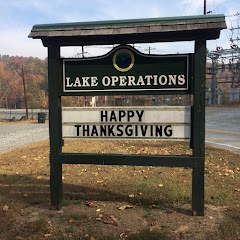
Town of Lake Lure, Lake Operations Office
Transit and Meeting Points
Useful pickup, handoff, or rendezvous points close to Columbus.
Spartanburg
Greenville
Clemson
Gastonia
Flight Path Map
This map shows the direct air route between Archdale and Asheville. Straight-line distance: 70.72 mi (113.82 km).

#1 Archdale
City in Randolph County, North Carolina, United States
| Population | 11,560 |
| Coordinates | 35.1940200, -81.4017500 |
| Altitude | 291 |
| Country | United States |

#2 Asheville
The most populous city in Buncombe County, North Carolina.
| Population | 92,852 |
| Coordinates | 35.6009500, -82.5540200 |
| Altitude | 649 |
| Country | United States |
End: (-82.554029, 35.600953)
Estimated Travel Time
Distance: 149 km by road
| Speed | Time |
|---|---|
| 30 mph (48.3 km/h) | 03h 04m |
| 40 mph (64.37 km/h) | 02h 18m |
| 50 mph (80.47 km/h) | 01h 50m |
| 60 mph (96.56 km/h) | 01h 32m |
| 70 mph (112.65 km/h) | 01h 19m |
| 80 mph (129 km/h) | 01h 09m |
Fuel, Round Trip and CO2
Estimated fuel cost and emissions for this route.
| Fuel | $/gal | One way | Round trip |
|---|---|---|---|
| Regular gas | $3.96 | $12.91 | $25.83 |
| Mid-grade | $4.43 | $14.44 | $28.88 |
| Premium | $4.78 | $15.58 | $31.15 |
| Diesel | $5.62 | $18.33 | $36.67 |
Assumes 8.3 L/100 km (about 28.3 MPG). CO2 is an estimate and varies by vehicle, fuel blend, traffic, and terrain.
Prices in North Carolina · Jun 25, 2026
Distance to Other Cities
Planning a road trip? See the full trip guide on Trip.ovh — stops, fuel costs, weather, and departure timing.