How far is Anza, CA from Long Beach, CA?
The driving distance from Anza, CA to Long Beach, CA is about 115.3 miles (185.6 km), with a travel time of about 02h 19m by car.
- The straight-line flight distance is about 88.4 miles (142.2 km).
- For a round trip, plan for roughly 04h 39m of driving time before adding stops, traffic, or weather delays.
- A comfortable departure window is usually 8:00 AM to 10:00 AM PDT.
Reverse, save, or send this route
This route works well as a day trip with time at the destination. Copy the route link, send it to another device, or print a clean version before you head out.
This route works well as a day trip with time at the destination.
Flight Distance
Driving Distance
Gas Cost Calculator
Leave and Arrive Planner
Pick a departure time to see your estimated arrival and same-day return window.
Drive time stays fixed at 02h 19m.
A morning start gives you useful time at the destination and keeps the return out of the late evening.
You are leaving earlier than the recommended window, which gives you extra margin for breaks and traffic.
Halfway Point
A useful midpoint for breaks, coffee, or meeting in the middle.
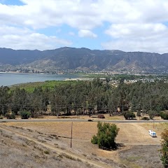
The most populous city in Lake County, California.
Route Weather Snapshot
Check the forecast at both ends before you head out.
Rain Showers Likely
Slight Chance Light Rain
Driving Route Map
The map below follows the saved road route between Anza and Long Beach.
Turn-by-Turn Driving Directions
Step-by-step road directions between Anza and Long Beach.
-
1
Start on Cahuilla Road
14.9 mi · 22 min · Cahuilla Road
-
2
At the end of the road, turn right
14 mi · 20 min
-
3
Continue on Temecula Parkway
3.6 mi · 5 min · Temecula Parkway
-
4
Take the ramp slight right toward I 15 North, CA 79: Riverside, Los Angeles
1919 ft · 49 sec
-
5
Merge slight left onto Escondido Freeway
4.6 mi · 5 min · Escondido Freeway
-
6
Continue on Temecula Valley Freeway
18.7 mi · 20 min · Temecula Valley Freeway
-
7
Continue on Corona Freeway
9.6 mi · 10 min · Corona Freeway
-
8
Keep slight right to continue on Corona Freeway
4.4 mi · 5 min · Corona Freeway
-
9
Take the exit slight right toward CA 91: Beach Cities, Riverside
953 ft · 23 sec · Corona Freeway
-
10
Keep slight left to continue on Corona Freeway
1.3 km · 2 min · Corona Freeway
-
11
Merge slight left
16.5 mi · 19 min
-
12
Keep slight left to continue on Costa Mesa Freeway
4.8 mi · 6 min · Costa Mesa Freeway
-
13
Take the exit slight right toward CA 22 West: Garden Grove Freeway, Long Beach
2569 ft · 40 sec
-
14
Merge slight left onto Garden Grove Freeway
12.7 mi · 15 min · Garden Grove Freeway
-
15
Continue on San Diego Freeway
1.7 mi · 2 min · San Diego Freeway
-
16
Take the exit slight right toward CA 22 West: Long Beach
2.5 mi · 4 min
-
17
Keep slight left to continue on East 7th Street
2.7 mi · 7 min · East 7th Street
-
18
Turn left onto Rose Avenue
1321 ft · 51 sec · Rose Avenue
-
19
At the end of the road, turn right onto East 4th Street
1.1 km · 2 min · East 4th Street
-
20
Turn left onto Alamitos Avenue
2029 ft · 1 min · Alamitos Avenue
-
21
Turn right onto East Ocean Boulevard
1888 ft · 1 min · East Ocean Boulevard
-
22
Arrive at your destination
0 m · 1 sec · East Ocean Boulevard
Car Route Details
A richer read on the saved driving route between Anza and Long Beach.
Highway-focused drive
Most of the mileage stays on named highways, so the important moments are ramps, exits, merges, and the final local approach.
Temecula Valley Freeway
Continue on Temecula Valley Freeway
18.7 mi · 00h 20m
Route Summary
A quick read on whether this route feels easy, ambitious, or worth planning around.
A comfortable day-trip route
This route works well as a day trip. You can leave in the morning, spend meaningful time at the destination, and still return the same day.
Rain Showers Likely leaving Anza and Slight Chance Light Rain near Long Beach.
Trip Questions
Direct answers travelers usually want before committing to the drive.
How long does it take to drive from Anza to Long Beach?
The road trip is about 115.3 miles (185.6 km) and usually takes 02h 19m in normal driving conditions.
Is this a same-day trip or an overnight route?
This route works well as a day trip. You can leave in the morning, spend meaningful time at the destination, and still return the same day.
What is the halfway point on this route?
Lake Elsinore is a useful midpoint, sitting about 57.1 miles from Anza and 58.2 miles from Long Beach.
How much longer is the road route than the straight-line distance?
The direct path is about 88.4 miles (142.2 km), while the road route adds roughly 26.9 extra miles because roads do not follow the straight air line.
When is the best time to leave for this route?
A good departure window is usually 8:00 AM to 10:00 AM PDT. If you want a more comfortable same-day return, try to leave by 1:50 PM PDT.
How much will gas cost for this route?
Using about 28.3 MPG, regular gas is estimated at $23.48 one way or $46.96 round trip. Estimated CO2 is about 36.2 kg one way.
What should you check before leaving?
Before you leave, expect Rain Showers Likely around Anza and Slight Chance Light Rain near Long Beach.
Stop Ideas Near Lake Elsinore
Useful break, food, and waypoint ideas within about 15 miles of the route midpoint.

Hilton Garden Inn Irvine East/Lake Forest

Rotary Park
City of Wildomar
City of Lake Elsinore
Transit and Meeting Points
Useful pickup, handoff, or rendezvous points close to Lake Elsinore.
Sun City, California
Perris, California
Moreno Valley, California
Hemet (West Florida Ave), California
Flight Path Map
This map shows the direct air route between Anza and Long Beach. Straight-line distance: 88.38 mi (142.23 km).
#1 Anza
Anza is a place in California, United States.
| Population | 0 |
| Coordinates | 33.5550300, -116.6736300 |
| Altitude | 1195 |
| Country | United States |

#2 Long Beach
The second most populous city in California, Long Beach is a major center for business, manufacturing, and tourism.
| Population | 454,681 |
| Coordinates | 33.7669600, -118.1892300 |
| Altitude | 9 |
| Country | United States |
End: E Ocean Boulevard (-118.189233, 33.766923)
Estimated Travel Time
Distance: 186 km by road
| Speed | Time |
|---|---|
| 30 mph (48.3 km/h) | 03h 50m |
| 40 mph (64.37 km/h) | 02h 52m |
| 50 mph (80.47 km/h) | 02h 18m |
| 60 mph (96.56 km/h) | 01h 55m |
| 70 mph (112.65 km/h) | 01h 38m |
| 80 mph (129 km/h) | 01h 26m |
Fuel, Round Trip and CO2
Estimated fuel cost and emissions for this route.
| Fuel | $/gal | One way | Round trip |
|---|---|---|---|
| Regular gas | $5.77 | $23.48 | $46.96 |
| Mid-grade | $6.07 | $24.69 | $49.38 |
| Premium | $6.24 | $25.41 | $50.82 |
| Diesel | $7.57 | $30.80 | $61.60 |
Assumes 8.3 L/100 km (about 28.3 MPG). CO2 is an estimate and varies by vehicle, fuel blend, traffic, and terrain.
Prices in California · Apr 11, 2026
Distance to Other Cities
Planning a road trip? See the full trip guide on Trip.ovh — stops, fuel costs, weather, and departure timing.