How far is Alexandria, VA from Apple Mountain Lake, VA?
The driving distance from Alexandria, VA to Apple Mountain Lake, VA is about 68.4 miles (110.1 km), with a travel time of about 01h 25m by car.
- The straight-line flight distance is about 57.4 miles (92.3 km).
- For a round trip, plan for roughly 02h 51m of driving time before adding stops, traffic, or weather delays.
- A comfortable departure window is usually 8:00 AM to 10:00 AM EDT.
Reverse, save, or send this route
This route works well as a day trip with time at the destination. Copy the route link, send it to another device, or print a clean version before you head out.
This route works well as a day trip with time at the destination.
Flight Distance
Driving Distance
Gas Cost Calculator
Leave and Arrive Planner
Pick a departure time to see your estimated arrival and same-day return window.
Drive time stays fixed at 01h 25m.
A morning start gives you useful time at the destination and keeps the return out of the late evening.
You are leaving earlier than the recommended window, which gives you extra margin for breaks and traffic.
Halfway Point
A useful midpoint for breaks, coffee, or meeting in the middle.
Town in Shenandoah County, Virginia, United States
Route Weather Snapshot
Check the forecast at both ends before you head out.
Sunny
Driving Route Map
The map below follows the saved road route between Alexandria and Apple Mountain Lake.
Turn-by-Turn Driving Directions
Step-by-step road directions between Alexandria and Apple Mountain Lake.
-
1
Start on South Washington Street
23 m · 7 sec · South Washington Street
-
2
Turn right onto King Street
96 m · 15 sec · King Street
-
3
Turn right onto South Saint Asaph Street
842 ft · 41 sec · South Saint Asaph Street
-
4
Turn right onto Duke Street
102 m · 19 sec · Duke Street
-
5
Turn left onto South Washington Street
1260 ft · 51 sec · South Washington Street
-
6
Turn right onto Gibbon Street
923 ft · 38 sec · Gibbon Street
-
7
Turn left onto South Patrick Street
1157 ft · 34 sec · South Patrick Street
-
8
Take the exit slight right toward I 95 South, I 495 West, I 95 North, I 495 East: Richmond, Baltimore
133 m · 11 sec
-
9
Keep slight right to continue on I 95 South, I 495 West
3238 ft · 1 min
-
10
Merge slight left onto Capital Beltway (Local)
5 mi · 6 min · Capital Beltway (Local)
-
11
Keep slight right to continue on Capital Beltway
1.1 km · 48 sec · Capital Beltway
-
12
Continue on Capital Beltway
2.4 mi · 3 min · Capital Beltway
-
13
Keep slight right to continue on Capital Beltway
5.7 mi · 7 min · Capital Beltway
-
14
Take the exit slight right toward I 66 West: Vienna, Front Royal
1.4 km · 2 min
-
15
Merge slight left
51.1 mi · 58 min
-
16
Take the exit slight right toward VA 79: Linden, Front Royal
1334 ft · 38 sec
-
17
Turn right onto Apple Mountain Road
527 ft · 23 sec · Apple Mountain Road
-
18
Continue on McIntosh Drive
2231 ft · 2 min · McIntosh Drive
-
19
At the end of the road, turn left onto Granny Smith Road
70 m · 13 sec · Granny Smith Road
-
20
Turn right onto Northern Spy Drive
1229 ft · 54 sec · Northern Spy Drive
-
21
Arrive at your destination
0 m · 1 sec · Northern Spy Drive
Car Route Details
A richer read on the saved driving route between Alexandria and Apple Mountain Lake.
Highway-focused drive
Most of the mileage stays on named highways, so the important moments are ramps, exits, merges, and the final local approach.
I 66 West
Merge slight left
51.1 mi · 00h 58m
Route Summary
A quick read on whether this route feels easy, ambitious, or worth planning around.
A comfortable day-trip route
This route works well as a day trip. You can leave in the morning, spend meaningful time at the destination, and still return the same day.
Sunny leaving Alexandria and Sunny near Apple Mountain Lake.
Trip Questions
Direct answers travelers usually want before committing to the drive.
How long does it take to drive from Alexandria to Apple Mountain Lake?
The road trip is about 68.4 miles (110.1 km) and usually takes 01h 25m in normal driving conditions.
Is this a same-day trip or an overnight route?
This route works well as a day trip. You can leave in the morning, spend meaningful time at the destination, and still return the same day.
What is the halfway point on this route?
New Market is a useful midpoint, sitting about 34.2 miles from Alexandria and 34.2 miles from Apple Mountain Lake.
How much longer is the road route than the straight-line distance?
The direct path is about 57.4 miles (92.3 km), while the road route adds roughly 11 extra miles because roads do not follow the straight air line.
When is the best time to leave for this route?
A good departure window is usually 8:00 AM to 10:00 AM EDT. If you want a more comfortable same-day return, try to leave by 3:38 PM EDT.
How much will gas cost for this route?
Using about 28.3 MPG, regular gas is estimated at $9.55 one way or $19.09 round trip. Estimated CO2 is about 21.4 kg one way.
What should you check before leaving?
Before you leave, expect Sunny around Alexandria and Sunny near Apple Mountain Lake.
Stop Ideas Near New Market
Useful break, food, and waypoint ideas within about 15 miles of the route midpoint.

Herndon Old Town Hall
Manassas Park City Hall
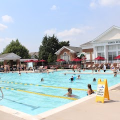
Town Hall Pool
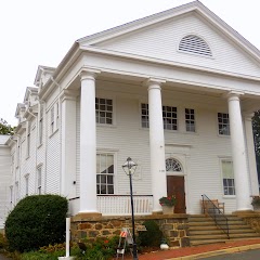
Old Town Hall
Transit and Meeting Points
Useful pickup, handoff, or rendezvous points close to New Market.
Manassas station
Burke Centre
Lorton station
Woodbridge station
Flight Path Map
This map shows the direct air route between Alexandria and Apple Mountain Lake. Straight-line distance: 57.33 mi (92.26 km).

#1 Alexandria
A city in Virginia.
| Population | 158,726 |
| Coordinates | 38.8048400, -77.0469200 |
| Altitude | 12 |
| Country | United States |
#2 Apple Mountain Lake
Apple Mountain Lake is a place in Virginia, United States.
| Population | 0 |
| Coordinates | 38.9242800, -78.1013900 |
| Altitude | 291 |
| Country | United States |
End: Apple Mountain Lake (-78.10139, 38.92428)
Estimated Travel Time
Distance: 110 km by road
| Speed | Time |
|---|---|
| 30 mph (48.3 km/h) | 02h 16m |
| 40 mph (64.37 km/h) | 01h 42m |
| 50 mph (80.47 km/h) | 01h 22m |
| 60 mph (96.56 km/h) | 01h 08m |
| 70 mph (112.65 km/h) | 00h 58m |
| 80 mph (129 km/h) | 00h 51m |
Fuel, Round Trip and CO2
Estimated fuel cost and emissions for this route.
| Fuel | $/gal | One way | Round trip |
|---|---|---|---|
| Regular gas | $3.96 | $9.55 | $19.09 |
| Mid-grade | $4.43 | $10.67 | $21.35 |
| Premium | $4.78 | $11.51 | $23.03 |
| Diesel | $5.62 | $13.55 | $27.11 |
Assumes 8.3 L/100 km (about 28.3 MPG). CO2 is an estimate and varies by vehicle, fuel blend, traffic, and terrain.
Prices in Virginia · Jul 14, 2026
Distance to Other Cities
Planning a road trip? See the full trip guide on Trip.ovh — stops, fuel costs, weather, and departure timing.