Cohutta, Georgia
Cohutta: human settlement in Whitfield County, Georgia, United States of America
About
Cohutta is a city located in the county of Whitfield in the U.S. state of Georgia. Its population at the 2010 census was 661 and a population density of 54 people per km². After 10 years in 2020 city had an estimated population of 644 inhabitants.
Quick Facts about Cohutta
| Population | 644 (2020) |
| Country | United States of America |
| State | Georgia (United States) |
| County | Whitfield County |
| Postal code | 30710 |
| Area | 12.14 km2 |
| Latitude & Longitude | 34.9595,-84.9527 |
| Altitude | 863 feet / 263 meters |
| Time Zone | America/New_York |
| Local time | 10:45:35 (3rd August 2026) |
| Density | 53 Pop. per km² as of 2020 |
| Population growth | -2.64% (2010-2020) |
| Weather | 68℉ Partly Cloudy 7-days weather |
Geography
Cohutta is located at 34°57'34"N 84°57'10"W (34.9595200, -84.9527200).
Cohutta map
Weather
Partly cloudy, with a low around 68. West wind around 0 mph.
7-Day ForecastDemographics
According to census records, the population of Cohutta decreased by 2.64% in 10 years.
| Year | Population | % Change | Method |
|---|---|---|---|
| 2010 | 661 | - | census |
| 2011 | 634 | -4.26% | estimation process |
| 2012 | 635 | 0.16% | estimation process |
| 2013 | 632 | -0.47% | estimation process |
| 2014 | 635 | 0.47% | estimation process |
| 2015 | 638 | 0.47% | estimation process |
| 2016 | 642 | 0.62% | estimation process |
| 2017 | 641 | -0.16% | estimation process |
| 2018 | 641 | 0% | estimation process |
| 2019 | 637 | -0.63% | estimation process |
| 2020 | 644 | 1.09% | estimation process |
Best Things to Do in Cohutta
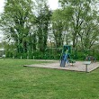
1Varnell Park
Main St, Cohutta, GA 30710, United States View details
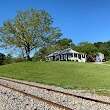
2Ed Painter's Railfan Spot
5267 Red Clay Rd, Cohutta, GA 30710, United States View details
Nearby Schools and Colleges
Schools and campuses linked to Cohutta, GA. Select a name to open its map and contact details.
| Code | Name | City | ZIP |
|---|---|---|---|
| 221661 | Southern Adventist University | Collegedale (TN) | 37315-0370 |
Closest post offices linked to Cohutta.
| Post Office Name | City | ZIP |
|---|---|---|
| Cohutta Post Office | Cohutta (GA) | 30710 |
Other cities in Whitfield County
Cities, towns, neighborhoods & other populated places in Whitfield County , GA.
| City Name | Population | Title |
|---|---|---|
| Dalton | 33,853 | City in Whitfield County, Georgia, United States |
| Varnell | 2,137 | City in Whitfield County, Georgia, United States of America |
| Tunnel Hill | 892 | City in Whitfield County, Georgia, United States of America |