Clarington, Pennsylvania
Clarington: Located in the northwestern part of Pennsylvania, this unincorporated community is situated primarily within Forest County along the banks of the Clarion River.
About
Clarington is a city located in the county of Forest in the U.S. state of Pennsylvania.
Quick Facts about Clarington
| State | Pennsylvania (United States) |
| County | Forest County |
| Latitude & Longitude | 41.3326,-79.1231 |
| Time Zone | America/New_York |
| Local time | 01:56:57 (8th November 2026) |
| Postal code | 15828 |
| Weather | 54℉ Mostly Sunny 7-days weather |
Geography
Clarington is located at 41°19'57"N 79°7'23"W (41.3325600, -79.1230900).
Clarington map
 icon to open full mode. View satellite images
Weather
Mostly sunny, with a high near 54. West wind 7 to 10 mph, with gusts as high as 25 mph.
7-Day ForecastBest Things to Do in Clarington
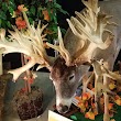
1Double Diamond Deer Ranch
12211 PA-36, Clarington, PA 15828, United States View details
Phone: +18147526334 | Website available
Nearby Schools and Colleges
Schools and campuses linked to Clarington, PA. Select a name to open its map and contact details.
| Code | Name | City | ZIP |
|---|---|---|---|
| 211644 | Clarion University of Pennsylvania | Clarion (PA) | 16214 |
Nearby Transit Stations (6)
Rail and bus stations connected to Clarington, PA. Select a station to open its map and address details.
| Code | Name | Address | Type |
|---|---|---|---|
| JMN | Jamestown, New York | 111 West Third Street | BUS |
| TYR | Tyrone | Pennsylvania Ave and West 10th St. | RAIL |
| ALT | Altoona Transportation Center | 1231 11th Avenue | RAIL |
| JST | Johnstown | 47 Walnut Street | RAIL |
| LAB | Latrobe station | 329 McKinley Ave | RAIL |
Closest post offices linked to Clarington.
| Post Office Name | City | ZIP |
|---|---|---|
| Sigel Post Office | Sigel (PA) | 15860 |