California Reference Map
With its enormous size and diverse terrain, a California reference map is useful for understanding the U.S. state's boundaries, cities, landmarks, and geographic features.
Boundaries
- California borders Oregon to the north, Nevada and Arizona to the east, the Mexican state of Baja California to the south, and has 800 miles of Pacific Ocean coastline to the west.
Major Cities
-
Sacramento - State capital located inland.
- Los Angeles - Largest city located in southern California along the coast.
- San Diego - Southern coastal city near the U.S.-Mexico border.
- San Francisco - Northern city known for its bay, cable cars and tech industry.
Geographic Features
-
Sierra Nevada Mountains - Mountain range stretching north-south along eastern California.
- Central Valley - Large interior agricultural region in central California.
- Mojave Desert - Arid region dominating southeast California.
- Pacific Coast - Over 800 miles of scenic Pacific coastline.
National Parks
-
Yosemite National Park - Iconic park in the Sierra Nevada Mountains.
- Death Valley National Park - Hot, arid park within the Mojave Desert.
- Redwood National Park - Protects coastal redwood forests.
In summary, a California reference map highlights the diversity of climate, topography, and settlement across this vast U.S. state.
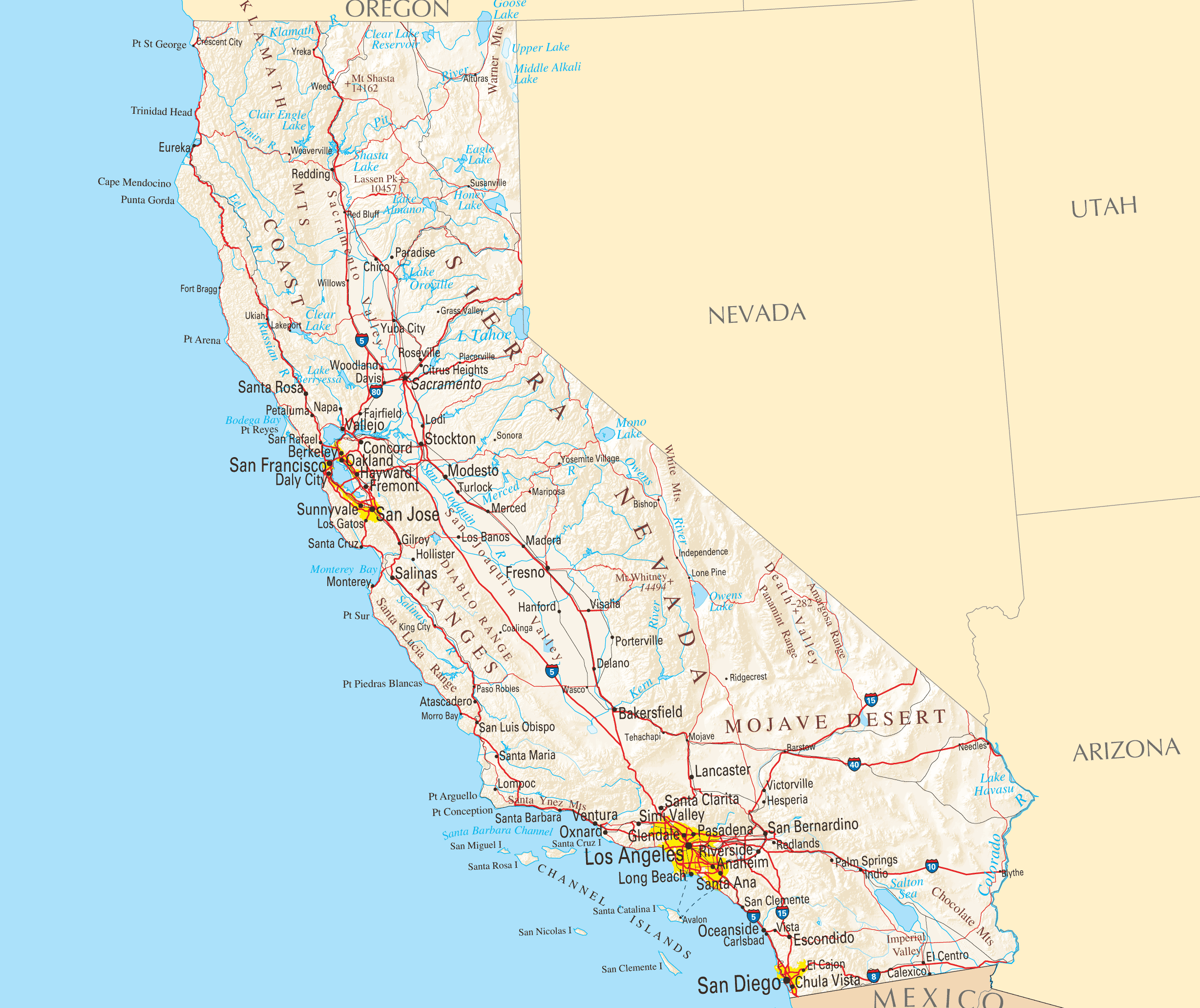
Click on the California Reference Map to view it full screen. File Type: PNG, File size: 655099 bytes (639.75 KB), Map Dimensions: 2457px x 2064px ( colors)
More California Static Maps
Alaska Airlines Flight 261 Path
593 x 450 - 34,915k - png
Amtrak California Simplified Map
909 x 1002 - 28,122k - png
Area Codes Ca
460 x 630 - 14,022k - png
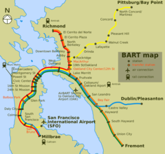
Bart Map
920 x 858 - 52,922k - png
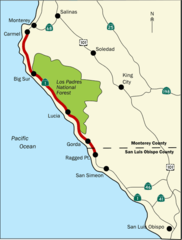
Bigsurmap
536 x 707 - 20,314k - png
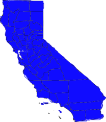
Blueca
521 x 599 - 14,051k - png
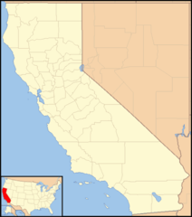
Ca District 50 Location
392 x 328 - 13,859k - png
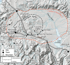
Calderarelief Large
620 x 574 - 291,705k - gif
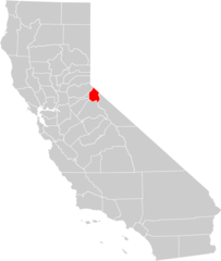
California Central Valley County Map
902 x 1065 - 30,833k - png

California Centralvalley County Map
292 x 500 - 13,342k - png
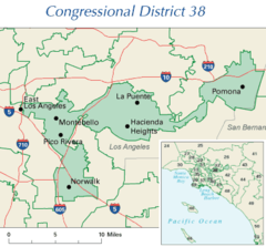
California District 38 2004
405 x 377 - 18,712k - png
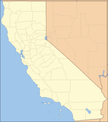
California Locator Map With Us
532 x 603 - 19,716k - png
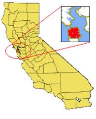
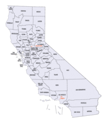
California Locator Map
596 x 676 - 9,363k - png
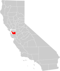
California Map Showing San Francisco County
200 x 246 - 5,447k - png
California Map
1146 x 1426 - 133,894k - jpg
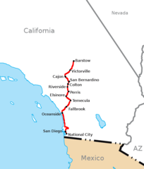
California Southern Railroad Route Map
648 x 760 - 13,722k - png
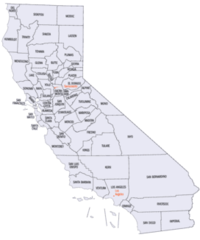
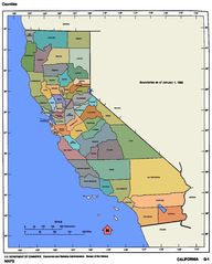
California Counties 300
272 x 326 - 12,425k - png
California Counties Map1
942 x 1081 - 54,262k - gif
California County Map (alameda County Highlighted)
902 x 1065 - 31,596k - png
California County Map (alpine County Highlighted)
902 x 1065 - 31,387k - png
California County Map (amador County Highlighted)
902 x 1065 - 31,607k - png
California County Map (butte County Highlighted)
902 x 1065 - 31,324k - png
California County Map (calaveras County Highlighted)
902 x 1065 - 31,471k - png
California County Map (colusa County Highlighted)
902 x 1065 - 31,352k - png
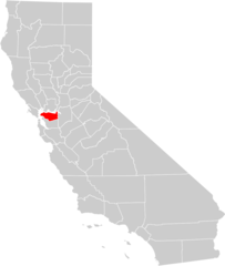
California County Map (contra Costa County Highlighted)
902 x 1065 - 31,410k - png
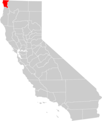
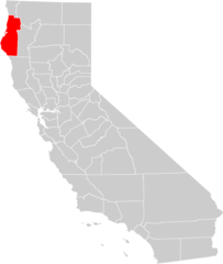
California County Map (del Norte County Highlighted)
902 x 1065 - 31,550k - png
California County Map (el Dorado County Highlighted)
902 x 1065 - 31,263k - png
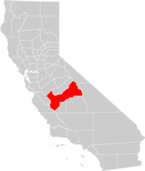
California County Map (fresno County Highlighted)
902 x 1065 - 31,314k - png
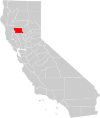
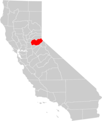
California County Map (glenn County Highlighted)
902 x 1065 - 31,581k - png
California County Map (humboldt County Highlighted)
902 x 1065 - 31,345k - png