Burney, California
Burney: census-designated place in Shasta County, California
About
Burney is a CDP located in the county of Shasta in the U.S. state of California.

Quick Facts about Burney
| Population | 3,154 |
| Country | United States of America |
| State | California (United States) |
| County | Shasta County |
| Postal code | 96013 |
| Water as percent of area | 0.09% |
| Land as percent of area | 99.91% |
| Latitude & Longitude | 40.8824,-121.6608 |
| Altitude | 3,123 feet / 952 meters |
| Time Zone | Pacific Time Zone, UTC−07:00, UTC−08:00 |
| Local time | 23:26:49 (14th July 2026) |
| Weather | 88℉ Sunny 7-days weather |
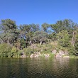
Geography
Burney is located at 40°52'57"N 121°39'39"W (40.8823800, -121.6608200).
Burney map
Weather
Sunny, with a high near 88. West southwest wind around 5 mph.
7-Day ForecastOfficial website of Burney
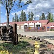
Official WebsiteServices and Civic Places in Burney
1Burney Chamber of Commerce
36879 Main St, Burney, CA 96013, United States View details
Phone: +15303352111 | Website available
2Highway Patrol
37332 CA-299, Burney, CA 96013, United States View details
Phone: +15303354581 | Website available
3Shasta County Sheriff - Burney Station
20509 Shasta St, Burney, CA 96013, United States View details
Phone: +15302456070 | Website available
4Shasta County Superior Court
20509 Shasta St # 6, Burney, CA 96013, United States View details
Phone: +15303353571 | Website available

Nearby Transit Stations (5)
Rail and bus stations connected to Burney, CA. Select a station to open its map and address details.
| Code | Name | Address | Type |
|---|---|---|---|
| DUN | Dunsmuir station | 5750 Sacramento Avenue | RAIL |
| RDD | Redding station | 1620 Yuba Street | RAIL |
| RDR | Redding (RABA Transit Center), California | 1530 Yuba Street | BUS |
| RBF | Red Bluff, California | 228 S. Main Street | BUS |
| CNG | Corning, California | 1081 Solano Street | BUS |
Closest post offices linked to Burney.
| Post Office Name | City | ZIP |
|---|---|---|
| Burney Post Office | Burney (CA) | 96013 |
Other cities in Shasta County
Cities, towns, neighborhoods & other populated places in Shasta County , CA.
| City Name | Population | Title |
|---|---|---|
| Redding | 92,456 | The most populous city in Shasta County, California. |
| Anderson | 10,565 | City in Shasta County, California, USA |
| Shasta Lake | 10,379 | City located in Shasta County, California |
| Shingletown | 2,283 | Census-designated place in Shasta County, California |
| Shasta | 1,771 | City located in Shasta County, California |
| Palo Cedro | 1,269 | Census-designated place in Shasta County, California |
Distance to Other Cities
Burney distances to largest California cities