Browns Mills, New Jersey
Browns Mills: census designated place
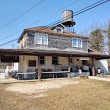
About
Browns Mills is a CDP located in the county of Burlington in the U.S. state of New Jersey.

Quick Facts about Browns Mills
| Population | 11,223 |
| Country | United States of America |
| State | New Jersey (United States) |
| County | Burlington County |
| Postal code | 08015 |
| Area | 14.55 km2 |
| Latitude & Longitude | 39.9726,-74.5829 |
| Altitude | 66 feet / 20 meters |
| Time Zone | Eastern Time Zone |
| Local time | 14:45:49 (17th July 2026) |
| Weather | 89℉ Smoke 7-days weather |

Geography
Browns Mills is located at 39°58'21"N 74°34'59"W (39.9726100, -74.5829300).
Browns Mills map
Weather
Smoke. Partly sunny, with a high near 89. North wind 0 to 5 mph.
7-Day ForecastBest Things to Do in Browns Mills
1Whitesbog Preservation Trust
120 W Whites Bogs Rd #34, Browns Mills, NJ 08015, United States View details
Phone: +16098934646 | Website available

2Whitesbog Historic Village
120 W Whites Bogs Rd # 34, Browns Mills, NJ 08015, United States View details
Phone: +16098934646 | Website available
People born in Browns Mills (1)
American actor, singer and songwriter Jon Hensley was born in Browns Mills
Nearby Schools and Colleges
Schools and campuses linked to Browns Mills, NJ. Select a name to open its map and contact details.
| Code | Name | City | ZIP |
|---|---|---|---|
| 430218 | Empire Beauty School-Bordentown | Bordentown (NJ) | 08505 |
Nearby Transit Stations (26)
Rail and bus stations connected to Browns Mills, NJ. Select a station to open its map and address details.
| Code | Name | Address | Type |
|---|---|---|---|
| TRE | Trenton Transit Center | 72 South Clinton Avenue | RAIL |
| CWH | Cornwells Heights | 700 Station Ave. | RAIL |
| ATO | Atco, New Jersey | Cooper Rd and Raritan Ave | OTHER |
| PJC | Princeton Junction station | 2 Wallace Road | RAIL |
| CRH | Cherry Hill, New Jersey | Cornell Ave. & West Marlton Pike | OTHER |
Closest post offices linked to Browns Mills.
| Post Office Name | City | ZIP |
|---|---|---|
| Browns Mill Post Office | Browns Mills (NJ) | 08015 |
Other cities in Burlington County
Cities, towns, neighborhoods & other populated places in Burlington County , NJ. (more)
| City Name | Population | Title |
|---|---|---|
| Mount Laurel | 41,870 | Township of New Jersey |
| Marlboro | 39,624 | Township of New Jersey |
| Willingboro | 32,014 | Township in Burlington County, New Jersey |
| Medford | 23,383 | Township in New Jersey |
| Burlington | 22,632 | City in New Jersey |
| Moorestown | 20,607 | Township of New Jersey |
| Maple Shade | 18,463 | Human settlement in Hamilton Township, New Jersey, United States of America |
| Springfield | 17,378 | Township in Union County, New Jersey, United States |
| Cinnaminson | 16,602 | Township in New Jersey |
| Fairview | 14,124 | Borough located in Bergen County, New Jersey |
| Lumberton | 12,182 | Township in Burlington County, New Jersey, United States |
| Bordentown | 12,064 | City in Burlington, New Jersey |
| Marlton | 10,133 | Census designated place in New Jersey, United States |
| Mount Holly | 9,525 | City in Gaston County, North Carolina |
| Westampton | 8,671 | Township of New Jersey |
| Edgewater Park | 8,639 | Township of New Jersey |
Distance to Other Cities
Browns Mills distances to largest New Jersey cities