Brasilia (Brasília), Federal District
Brasilia:
About
County Snapshot
Brasília at a glance
Brasília currently has 1 quality-checked populated place pages linked on MapSof, making it easier to jump from the county overview into local city pages.
Mapped populated places
1
These counts use a stricter populated-place filter so the main lists stay focused on real city and town pages.
Federal District counties
1
Open related pagesLargest city
BrasíliaPopulation 3,015,268
Top linked places
Quick Facts about Brasília
| State | Federal District (Brazil) |
| Latitude & Longitude | -15.7916,-47.8956 |
| Time Zone | America/Sao_Paulo |
| Local time | 16:56:21 (24th July 2026) |
Geography
Brasília is located at 15°47'30"S 47°53'44"W (-15.7915900, -47.8955800).
Brasilia map
Click "full screen"  icon to open full mode. View satellite images
The largest city of Brasília is Brasília with a population of 3,015,268. . See all Brasília cities & populated places.
Brazilija, Бразилия
Map & Images (more maps)
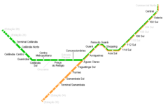
Brasilia Metro Map
1982 x 744
- 99,844k -
png