Arad (Arad Airport), Arad
Arad:
About
Quick Facts about Arad Airport
| State | Arad (Romania) |
| County | Municipiul Arad |
| Latitude & Longitude | 46.1766,21.2620 |
| Time Zone | Europe/Bucharest |
| Local time | 03:17:33 (2nd July 2026) |
Geography
Arad Airport is located at 46°10'36"N 21°15'43"E (46.1765500, 21.2620200).
Arad map
Click "full screen"  icon to open full mode. View satellite images
ARW, LRAR
Map & Images (more maps)
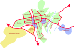
Arad Map
1600 x 1048
- 72,309k -
png
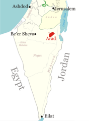
Location of Arad
750 x 1016
- 42,303k -
png
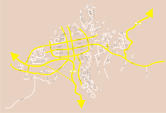
Map of Arad
2011 x 1376
- 128,591k -
png