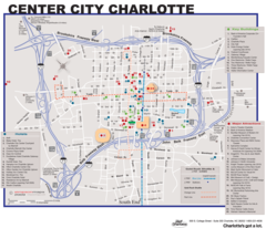
Charlotte Downtown Map (city Center)
Charlotte's downtown area comprises the city center and urban core of North Carolina's largest city. Exploring a map of downtown Charlotte provides insight into the layout and attractions of this modern southern city.
Wards
Downtown Charlotte contains four central wards:
- First Ward - Home to Bank of America Stadium and BB&T Ballpark.
- Second Ward - Includes the NASCAR Hall of Fame and Convention Center.
- Third Ward - Financial district with skyscrapers and new development.
- Fourth Ward - Historic neighborhoods bordering Johnson C. Smith University.
Main Thoroughfares
-
Tryon St. - Main north-south street lined with restaurants and bars.
- Trade and Tryon Sts. - Major intersection known as "The Square."
- Levine Ave. - Recently developed pedestrian-friendly avenue.
Points of Interest
-
Bank of America Corporate Center - Iconic skyscraper headquarters.
- Spectrum Center - Indoor arena home to the NBA's Hornets.
- Bechtler Museum of Modern Art - Showcases mid-20th century modern works.
In summary, downtown Charlotte's wards, thoroughfares, and attractions reflect this fast-growing southern city's emergence as a major financial hub and cultural destination.
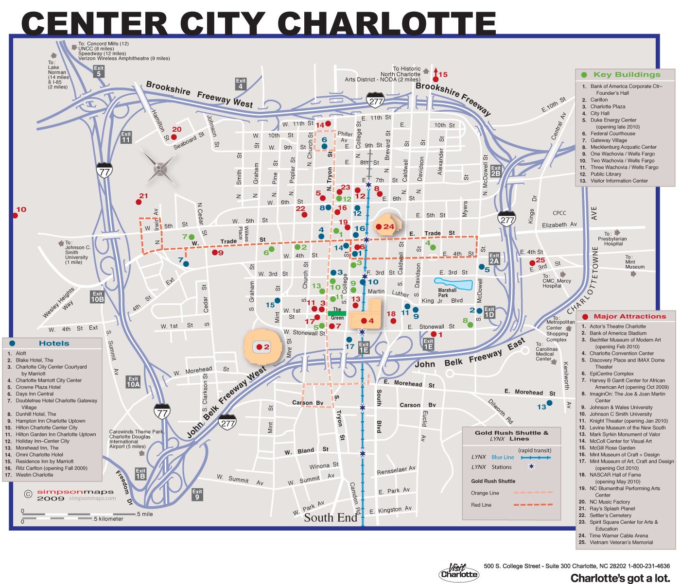
Click on the Charlotte Downtown Map (city Center) to view it full screen. File Type: png, File size: 208845 bytes (203.95 KB), Map Dimensions: 1399px x 1202px (256 colors)
More Charlotte Static Maps
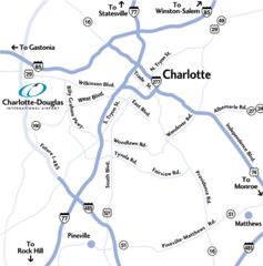
Charlotte Airport Location Map
791 x 800 - 115,937k - png
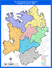
Charlotte Districts Map
990 x 1300 - 127,007k - png
Charlotte Downtown Map (city Center)
1399 x 1202 - 208,845k - png
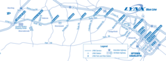
Charlotte Light Rail Map
1599 x 588 - 95,975k - png
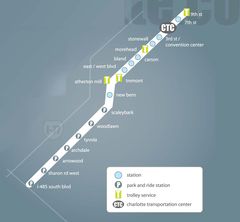
Charlotte Light Rail Map (metro)
1190 x 1102 - 54,228k - jpg
Charlotte Tourist Map
2250 x 1504 - 553,965k - jpg
Charlotte Metro Map
577 x 532 - 4,311k - png