Where Is Virginia Located
Virginia is located on the east coast of the United States. Some key facts about the location and geography of Virginia:
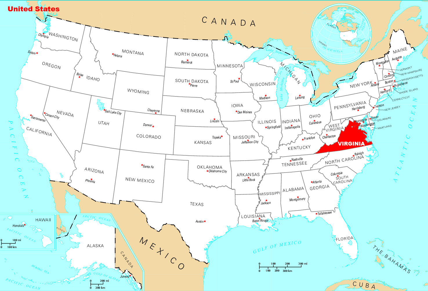
- Virginia is bordered by Maryland and Washington D.C. to the north, the Atlantic Ocean to the east, North Carolina to the south, and West Virginia and Kentucky to the west.
- The state has a long coastal plain on the eastern side, extending from the Chesapeake Bay and Atlantic Ocean westward. This region includes the Virginia Beach-Norfolk-Newport News metropolitan area.
- The central and western parts of Virginia are marked by the Blue Ridge Mountains and the Appalachian Mountains, including the Shenandoah Valley region between the mountain ranges.
- Major rivers in Virginia include the James River, York River, Rappahannock River, Potomac River (forms part of the northern border), and the Tennessee River (forms part of the western border).
- The state's capital and most populous city is Richmond, located in the central part of the state. Other major cities include Virginia Beach, Norfolk, Chesapeake, Newport News, Alexandria, and Roanoke.
- Virginia is considered to be in the South Atlantic region of the United States. However, the northern part of the state is also associated with the Mid-Atlantic.
- In total, Virginia covers over 42,700 square miles of land and has a population of over 8.5 million (as of 2019). It was one of the original 13 colonies that declared independence from Great Britain.
So in summary, Virginia occupies a strategic location along the eastern seaboard and includes coastal, piedmont, mountain, and valley geographic regions within its borders. Its proximity to Washington D.C. also gives it an important place in the political and economic affairs of the country.
Click on the Where Is Virginia Located to view it full screen. File Type: png, File size: 135445 bytes (132.27 KB), Map Dimensions: 1476px x 1002px (256 colors)